MyTopo
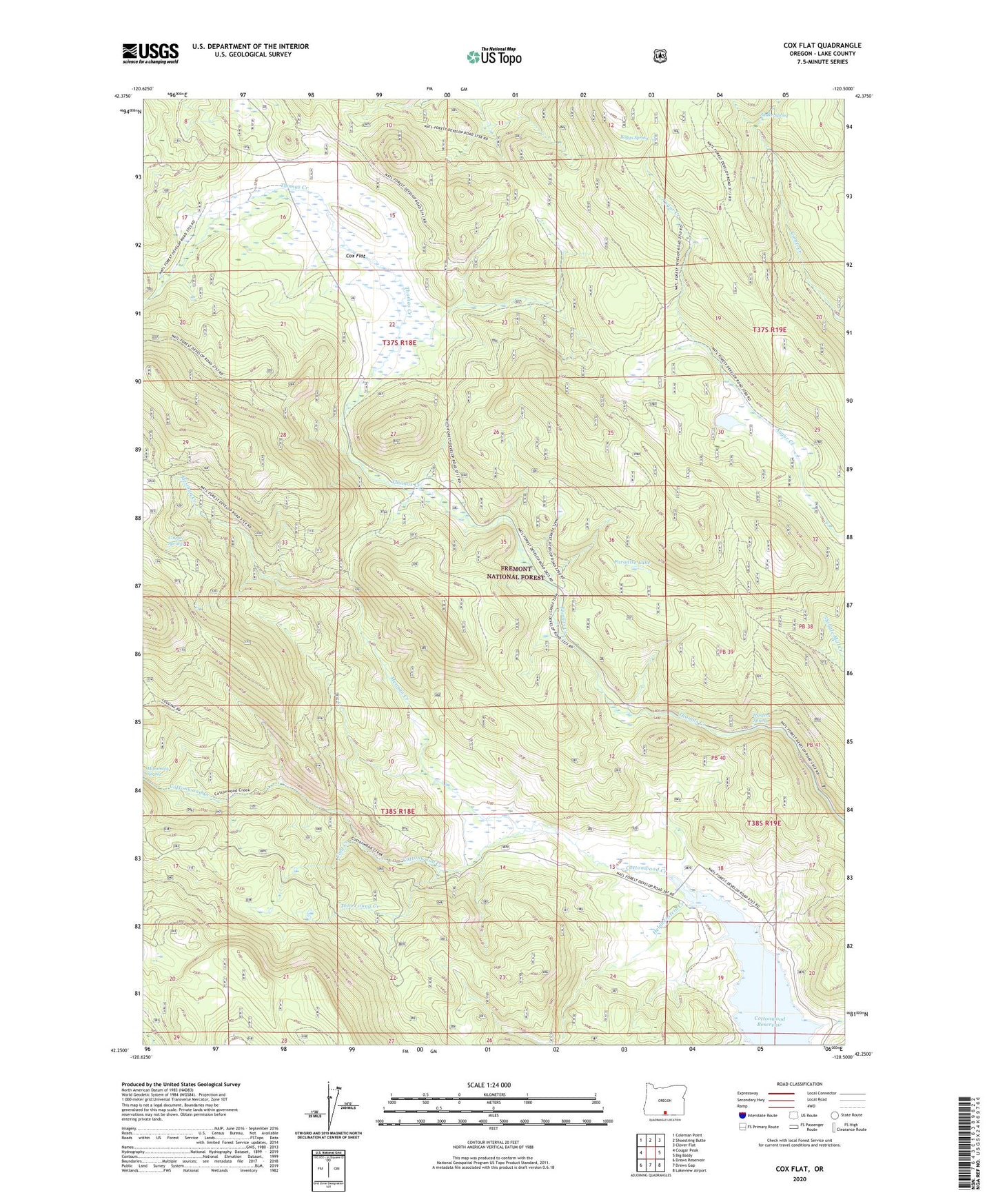
Cox Flat Oregon US Topo Map
Couldn't load pickup availability
Also explore the Cox Flat Forest Service Topo of this same quad for updated USFS data
2023 topographic map quadrangle Cox Flat in the state of Oregon. Scale: 1:24000. Based on the newly updated USGS 7.5' US Topo map series, this map is in the following counties: Lake. The map contains contour data, water features, and other items you are used to seeing on USGS maps, but also has updated roads and other features. This is the next generation of topographic maps. Printed on high-quality waterproof paper with UV fade-resistant inks.
Quads adjacent to this one:
West: Cougar Peak
Northwest: Coleman Point
North: Shoestring Butte
Northeast: Clover Flat
East: Big Baldy
Southeast: Lakeview Airport
South: Drews Gap
Southwest: Drews Reservoir
This map covers the same area as the classic USGS quad with code o42120c5.
Contains the following named places: Boggs Spring, Cold Creek, Cottonwood Creek Trailhead, Cottonwood Reservoir, Cottonwood Reservoir County Park, Cougar Springs, Cox Flat, Garrett Place, Helphenstein Creek, Hunters Spring, Irishmans Campground, Lucky Lass Mine, Mesman Creek, Paradise Lake, Snake Spring, Thomas Creek Campground, Tom Young Creek, White King Mine