MyTopo
Shoestring Butte Oregon US Topo Map
Couldn't load pickup availability
Also explore the Shoestring Butte Forest Service Topo of this same quad for updated USFS data
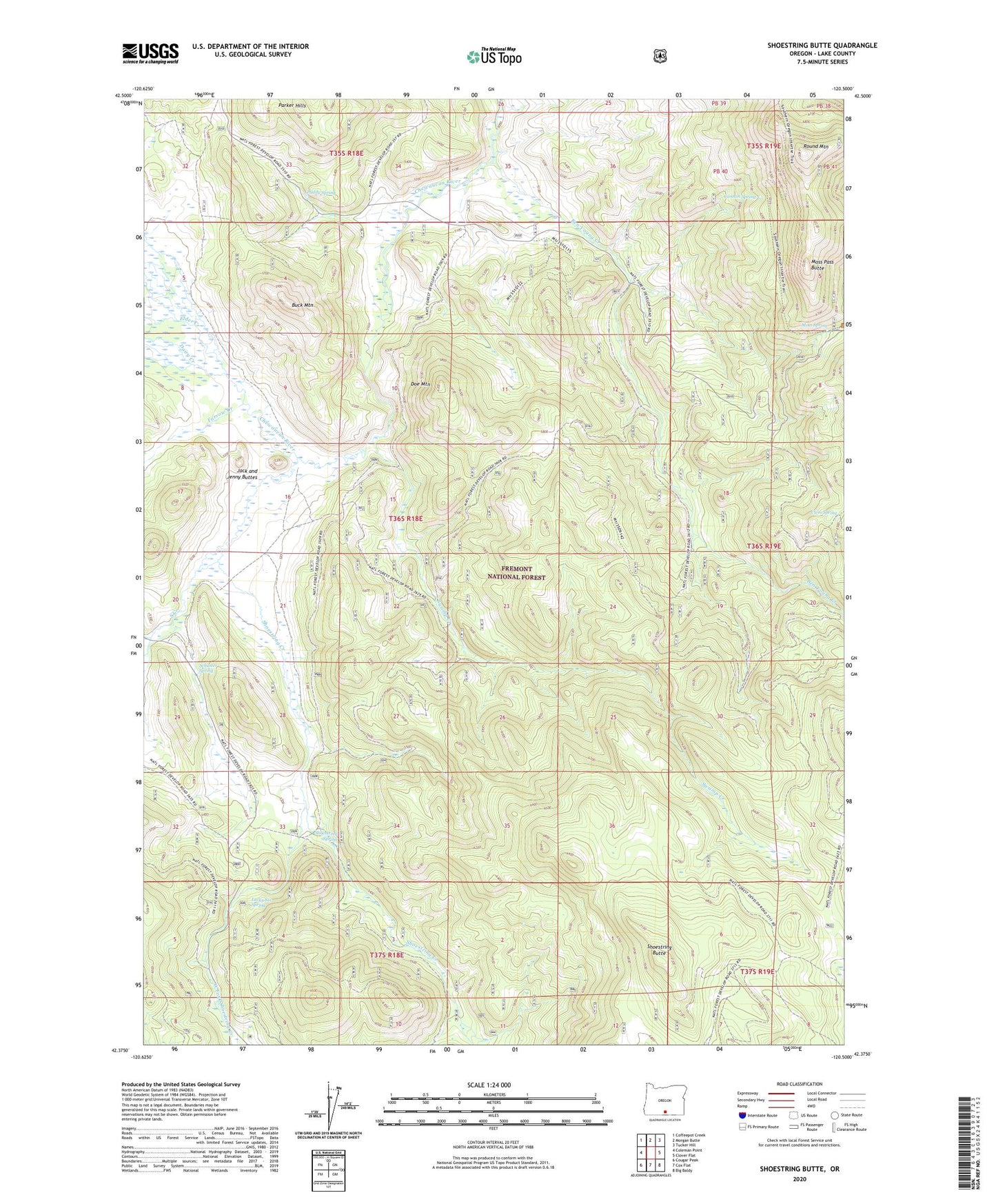
2023 topographic map quadrangle Shoestring Butte in the state of Oregon. Scale: 1:24000. Based on the newly updated USGS 7.5' US Topo map series, this map is in the following counties: Lake. The map contains contour data, water features, and other items you are used to seeing on USGS maps, but also has updated roads and other features. This is the next generation of topographic maps. Printed on high-quality waterproof paper with UV fade-resistant inks.
Quads adjacent to this one:
West: Coleman Point
Northwest: Coffeepot Creek
North: Morgan Butte
Northeast: Tucker Hill
East: Clover Flat
Southeast: Big Baldy
South: Cox Flat
Southwest: Cougar Peak
This map covers the same area as the classic USGS quad with code o42120d5.
Contains the following named places: Ben Young Creek, Buck Mountain, Cannon Spring, Clem Spring, Dairy Creek, Dicks Pond, Doe Mountain, Elder Creek, Farrow Creek, Gaylord Ranch, Jack and Jenny Buttes, Lucky Six Spring, Moss Pass Butte, Moss Spring, Paddy Spring, Parker Hills, Round Mountain, Round Pass, Schuster Place, Schuster Spring, Shoestring Butte, Shoestring Creek, Shoestring Spring, South Creek, Swamp Creek, Thomas Creek Work Center, West Fork Shoestring Creek