MyTopo
Lake Abert South Oregon US Topo Map
Couldn't load pickup availability
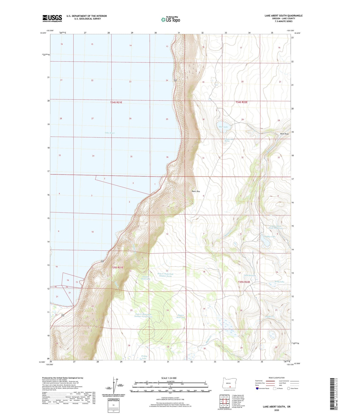
2024 topographic map quadrangle Lake Abert South in the state of Oregon. Scale: 1:24000. Based on the newly updated USGS 7.5' US Topo map series, this map is in the following counties: Lake. The map contains contour data, water features, and other items you are used to seeing on USGS maps, but also has updated roads and other features. This is the next generation of topographic maps. Printed on high-quality waterproof paper with UV fade-resistant inks.
Quads adjacent to this one:
West: Coglan Buttes SE
Northwest: Coglan Buttes NE
North: Lake Abert North
Northeast: Commodore Ridge
East: Cooper Draw
Southeast: Drake Peak NE
South: Little Honey Creek
Southwest: Valley Falls
This map covers the same area as the classic USGS quad with code o42120e2.
Contains the following named places: Abert Rim, Abert Rim Historical Marker, Chewaucan River, Cold Creek, Colvin Lake, Colvin Timbers, Fish Creek Waterhole Number Forty, Fish Creek Waterhole Number Forty-seven, Juniper Creek, Juniper Waterhole, Lower Basin Draw Reservoir, Mule Draw, Mule Lake, Paddys Lake, Poison Creek, Sheep Creek Spring, Spawn Reservoir, Webb Lake, Webb Springs