MyTopo
Cedar Butte Oregon US Topo Map
Couldn't load pickup availability
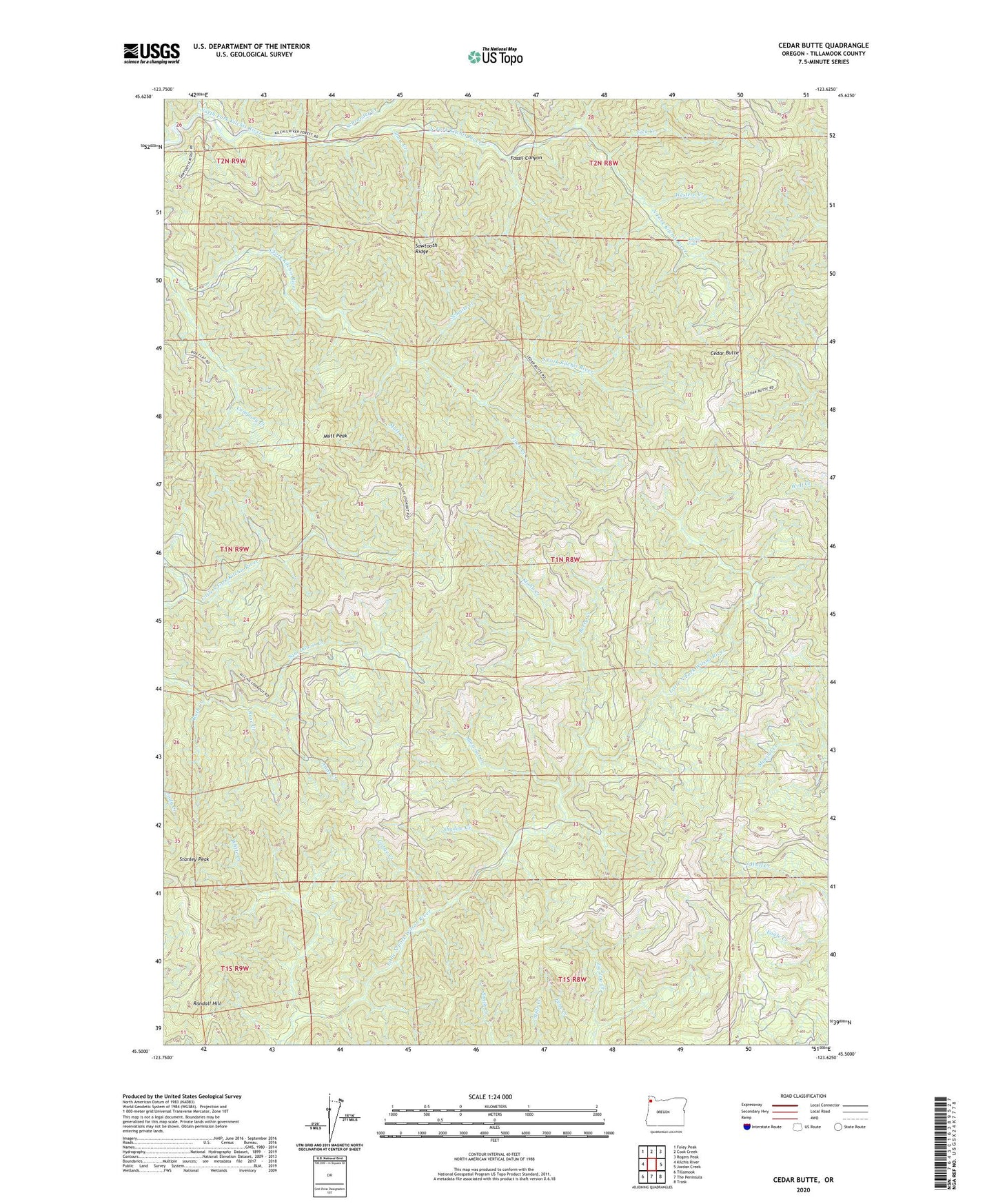
2024 topographic map quadrangle Cedar Butte in the state of Oregon. Scale: 1:24000. Based on the newly updated USGS 7.5' US Topo map series, this map is in the following counties: Tillamook. The map contains contour data, water features, and other items you are used to seeing on USGS maps, but also has updated roads and other features. This is the next generation of topographic maps. Printed on high-quality waterproof paper with UV fade-resistant inks.
Quads adjacent to this one:
West: Kilchis River
Northwest: Foley Peak
North: Cook Creek
Northeast: Rogers Peak
East: Jordan Creek
Southeast: Trask
South: The Peninsula
Southwest: Tillamook
This map covers the same area as the classic USGS quad with code o45123e6.
Contains the following named places: Anns Creek, Bay City Division, Berry Creek, Blowout Creek, Cedar Butte, Company Creek, Fick Creek, Fitch Creek, Fossil Canyon, Gorge Creek, Kilchis Falls, Kilchis Lookout, Klahn Creek, Mutt Creek, Mutt Peak, Randall Hill, Ripple Creek, Rose Creek, Ruth Creek, Sawtooth Ridge, Schmitz Creek, Schroeder Creek, Shadow Creek, Shaw Creek, Stanley Peak, Triangulation Creek, Western Creek, White Creek, ZIP Code: 97141