MyTopo
Cooks Mountain Oregon US Topo Map
Couldn't load pickup availability
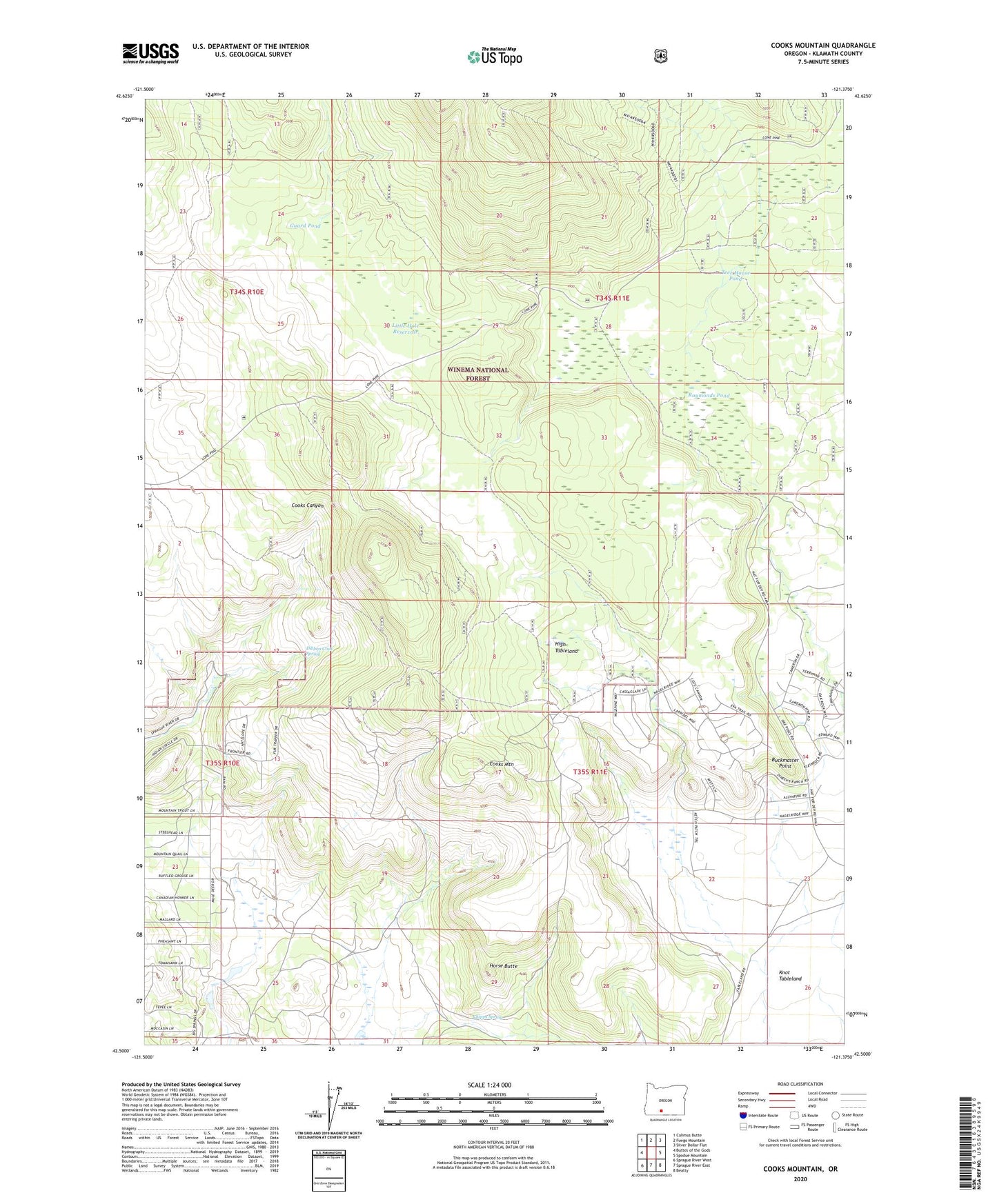
2020 topographic map quadrangle Cooks Mountain in the state of Oregon. Scale: 1:24000. Based on the newly updated USGS 7.5' US Topo map series, this map is in the following counties: Klamath. The map contains contour data, water features, and other items you are used to seeing on USGS maps, but also has updated roads and other features. This is the next generation of topographic maps. Printed on high-quality waterproof paper with UV fade-resistant inks.
Quads adjacent to this one:
West: Buttes of the Gods
Northwest: Calimus Butte
North: Fuego Mountain
Northeast: Silver Dollar Flat
East: Spodue Mountain
Southeast: Beatty
South: Sprague River East
Southwest: Sprague River West
Contains the following named places: Buck Spring Pond, Buckmaster Point, Chipps Spring, Cooks Mountain, Dibbon Cook Spring, Guard Pond, High Table Pond, High Tableland, Horse Butte, Knife Pond, Little Hole Reservoir, Raymonds Camp, Raymonds Pond, Some Chance Pond, Tree House Pond