MyTopo
Beatty Oregon US Topo Map
Couldn't load pickup availability
Also explore the Beatty Forest Service Topo of this same quad for updated USFS data
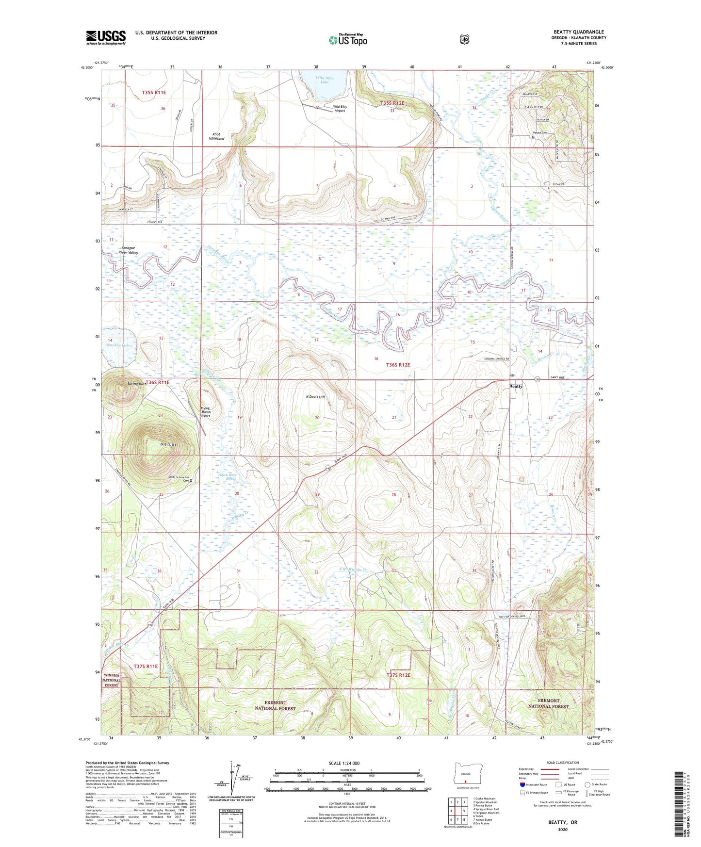
2023 topographic map quadrangle Beatty in the state of Oregon. Scale: 1:24000. Based on the newly updated USGS 7.5' US Topo map series, this map is in the following counties: Klamath. The map contains contour data, water features, and other items you are used to seeing on USGS maps, but also has updated roads and other features. This is the next generation of topographic maps. Printed on high-quality waterproof paper with UV fade-resistant inks.
Quads adjacent to this one:
West: Sprague River East
Northwest: Cooks Mountain
North: Spodue Mountain
Northeast: Ponina Butte
East: Ferguson Mountain
Southeast: Dry Prairie
South: Yainax Butte
Southwest: Yonna
This map covers the same area as the classic USGS quad with code o42121d3.
Contains the following named places: Beatty, Beatty Census Designated Place, Beatty Post Office, Beatty Station, Brown Creek, Bug Butte, Chief Schonchin Cemetery, Crater Lake Camp, East Branch Whisky Creek, Flying T Ranch Airport, Gunsight Well, K Davis Hill, Klamath Reservation, Lola K West Spring, Modoc Billy Creek, Paiute Cemetery, Smokey Lake, Snake Creek, Spring Butte, Spring Creek, Sycan, Sycan River, Whisky Creek, Wild Billy Airport, Williams Drain, ZIP Code: 97621