MyTopo
Coquille Oregon US Topo Map
Couldn't load pickup availability
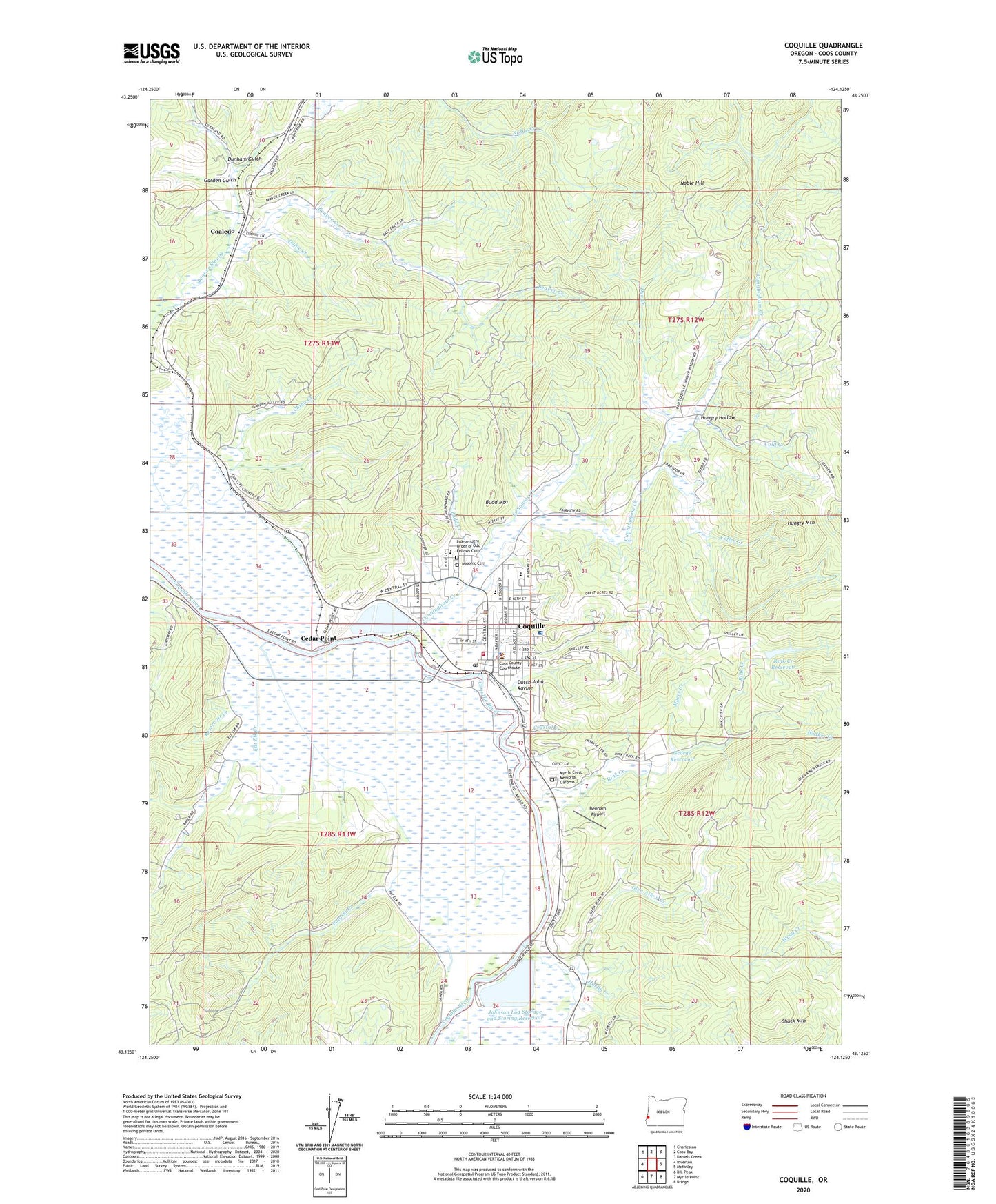
2023 topographic map quadrangle Coquille in the state of Oregon. Scale: 1:24000. Based on the newly updated USGS 7.5' US Topo map series, this map is in the following counties: Coos. The map contains contour data, water features, and other items you are used to seeing on USGS maps, but also has updated roads and other features. This is the next generation of topographic maps. Printed on high-quality waterproof paper with UV fade-resistant inks.
Quads adjacent to this one:
West: Riverton
Northwest: Charleston
North: Coos Bay
Northeast: Daniels Creek
East: McKinley
Southeast: Bridge
South: Myrtle Point
Southwest: Bill Peak
This map covers the same area as the classic USGS quad with code o43124b2.
Contains the following named places: 5th Street Park, 97423, A B Crossing, Anderson Creek, Baisen, Beaver Creek, Beaver Hill Junction, Benham Airport, Budd Creek, Budd Mountain, Calloway Creek, Cedar Point, Chrome, City of Coquille, Coaledo, Coaledo Post Office, Coffee Creek, Cold Creek, Coos County Courthouse, Coos County Jail, Coos County Public Works, Coos County Sheriff's Office, Coquile Museum, Coquille, Coquille Boat Ramp, Coquille City Hall, Coquille Division, Coquille Fire and Rescue, Coquille Foursquare Church, Coquille High School, Coquille Municipal Court, Coquille Police Department, Coquille Post Office, Coquille Public Library, Coquille Public Works, Coquille Sewage Treatment Plant, Coquille Valley Hospital, Coquille Valley Intermediate School, Coquille Water Treatment Plant, Crystal Creek, Cunningham Creek, Department of Motor Vehicles Coquille, Dufoe Creek, Dunham Gulch, Dutch John Ravine, Dye Creek, Emmanuel Baptist Church of Coquille Oregon, Fairview Junction, Fall Creek, Fat Elk Creek, Fortier Field, G H Chaney Logging Railroad Crossing, Garden Gulch, George Reservoir, Glen Aiken Creek, Harlin Creek, Hungry Hollow, Hungry Mountain, Independent Order of Odd Fellows Cemetery, Jefferson School, Johnson, Johnson Log Storage and Sorting Dam, Johnson Log Storage and Storing Reservoir, KSHR-AM, Lincoln Elementary School, Lions Club Park, Masonic Cemetery, Montgomerys Cabin, Myers Creek, Myrtle Crest Memorial Gardens, Noble Hill, North Fork Glen Aiken Creek, Overland, Overland Mine, Penny Sturdivant Park, Phil Creek, Pulaski Creek, Reservoir Creek, Rink Creek, Rink Creek Dam, Rink Creek Reservoir, Sanford Heights Park, Sanford Heights Playground, Sawdust Theatre, Shuck Mountain, Sturdivant Park Boat Ramp, United Valley Christian Academy, Walker Creek, Washington School, Yoakum