MyTopo
Daniels Creek Oregon US Topo Map
Couldn't load pickup availability
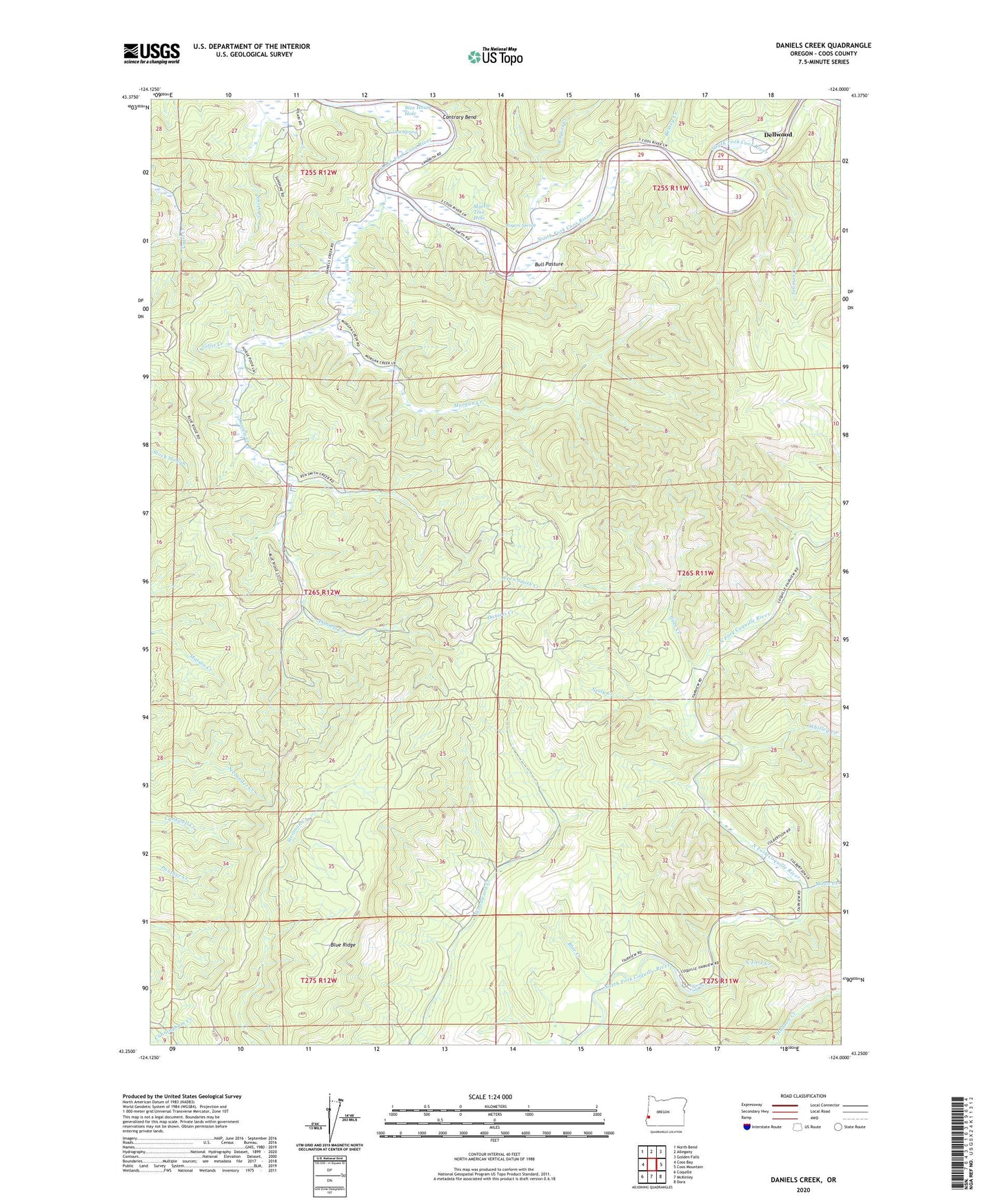
2023 topographic map quadrangle Daniels Creek in the state of Oregon. Scale: 1:24000. Based on the newly updated USGS 7.5' US Topo map series, this map is in the following counties: Coos. The map contains contour data, water features, and other items you are used to seeing on USGS maps, but also has updated roads and other features. This is the next generation of topographic maps. Printed on high-quality waterproof paper with UV fade-resistant inks.
Quads adjacent to this one:
West: Coos Bay
Northwest: North Bend
North: Allegany
Northeast: Golden Falls
East: Coos Mountain
Southeast: Dora
South: McKinley
Southwest: Coquille
This map covers the same area as the classic USGS quad with code o43124c1.
Contains the following named places: Bessey Creek, Blue Creek, Blue Ridge, Bull Pasture, Contrary Bend, Coos River School, Daniels Creek, Dellwood, Dellwood Post Office, Giles Creek, Gillis Creek, KSHR-FM, Landrith Bridge, LaVerne County Park, Laverne Falls, Luse Spring, Moon Creek, Morgan Creek, Myrtle Tree Boat Ramp, Myrtle Tree Hole, Neely Creek, Newcastle Mine, North Fork Creek, Rogers Creek, Rogers Spring, Seaman Creek, West La Verne Park, Whitley Creek, Wren Smith Creek