MyTopo
Red Bank Lakes Oregon US Topo Map
Couldn't load pickup availability
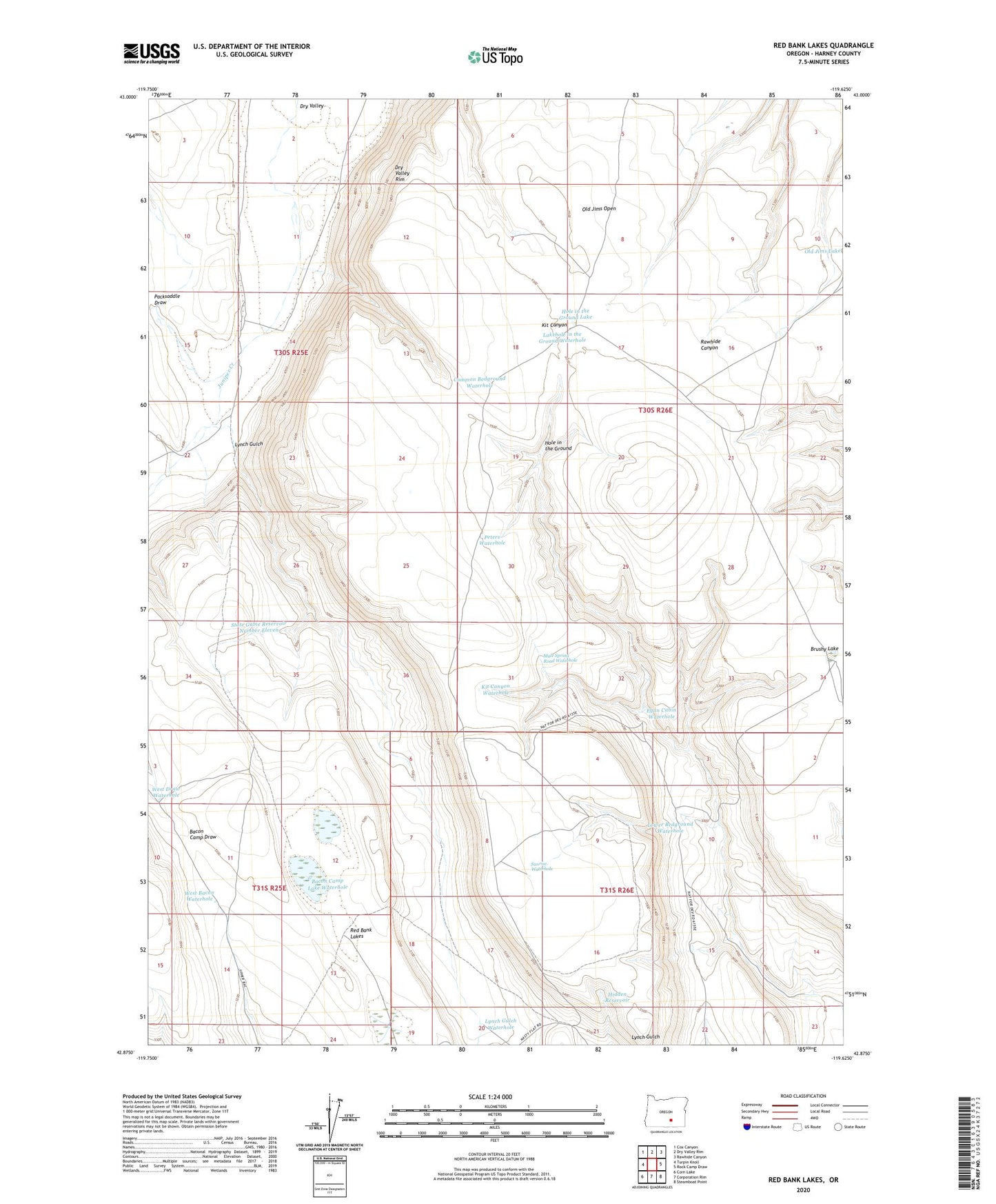
2023 topographic map quadrangle Red Bank Lakes in the state of Oregon. Scale: 1:24000. Based on the newly updated USGS 7.5' US Topo map series, this map is in the following counties: Harney. The map contains contour data, water features, and other items you are used to seeing on USGS maps, but also has updated roads and other features. This is the next generation of topographic maps. Printed on high-quality waterproof paper with UV fade-resistant inks.
Quads adjacent to this one:
West: Turpin Knoll
Northwest: Cox Canyon
North: Dry Valley Rim
Northeast: Rawhide Canyon
East: Rock Camp Draw
Southeast: Steamboat Point
South: Corporation Rim
Southwest: Corn Lake
This map covers the same area as the classic USGS quad with code o42119h6.
Contains the following named places: Bacon Camp Lake Waterhole, Brushy Lake, Common Bedground Waterhole, Egan Cabin, Egan Cabin Waterhole, Hidden Reservoir, Hole in the Ground, Hole in the Ground Lake, Kit Canyon Waterhole, Lakehole in the Ground Waterhole, Lower Bedground Waterhole, Lynch Gulch, Lynch Gulch Waterhole, Mule Spring Road Waterhole, Old Jims Open, Packsaddle Draw, Peters Waterhole, Red Bank Lakes, State Game Reservoir Number Eleven, Sunrise Waterhole, West Bacon Waterhole, West Draw Waterhole