MyTopo
Cove Oregon US Topo Map
Couldn't load pickup availability
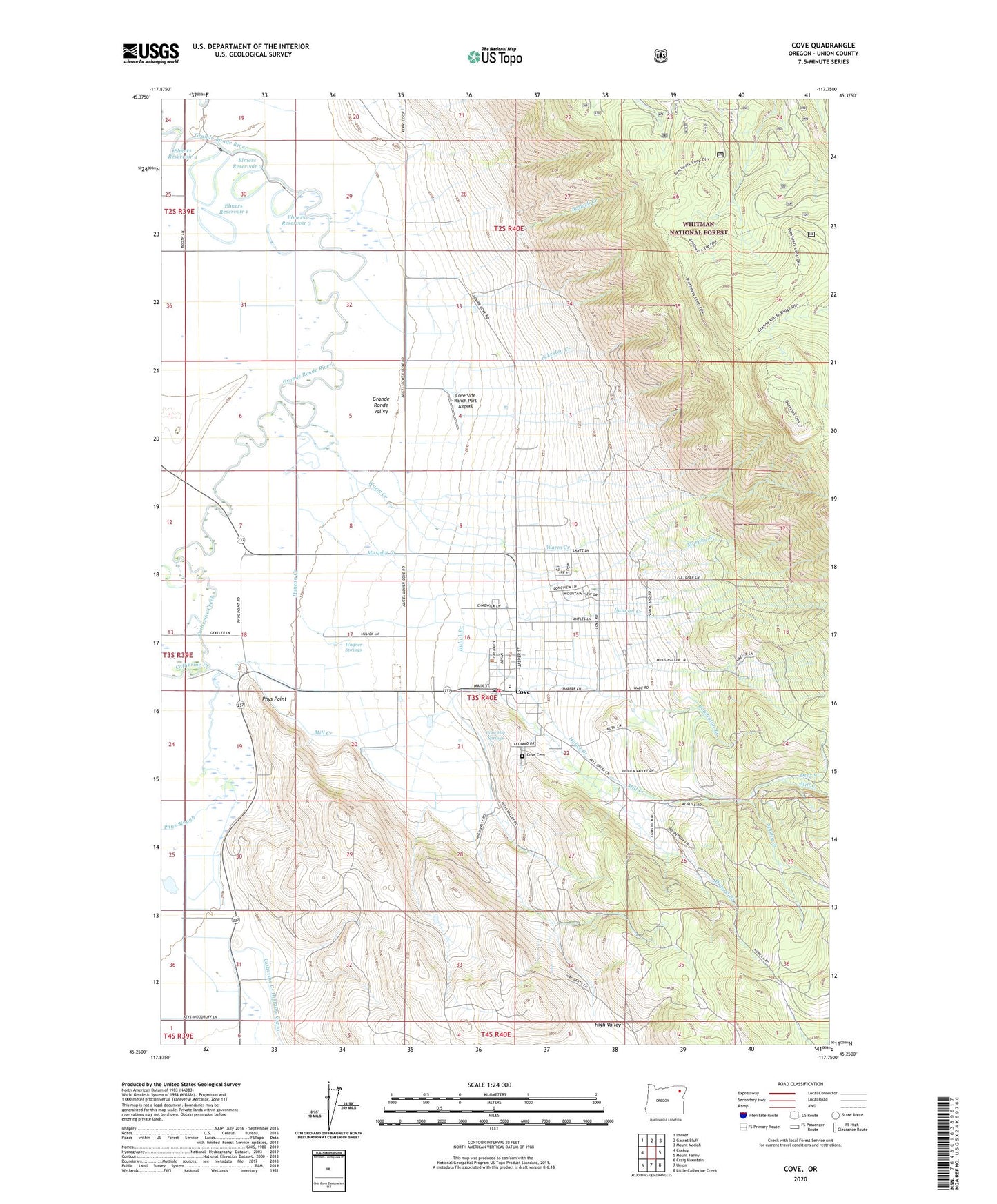
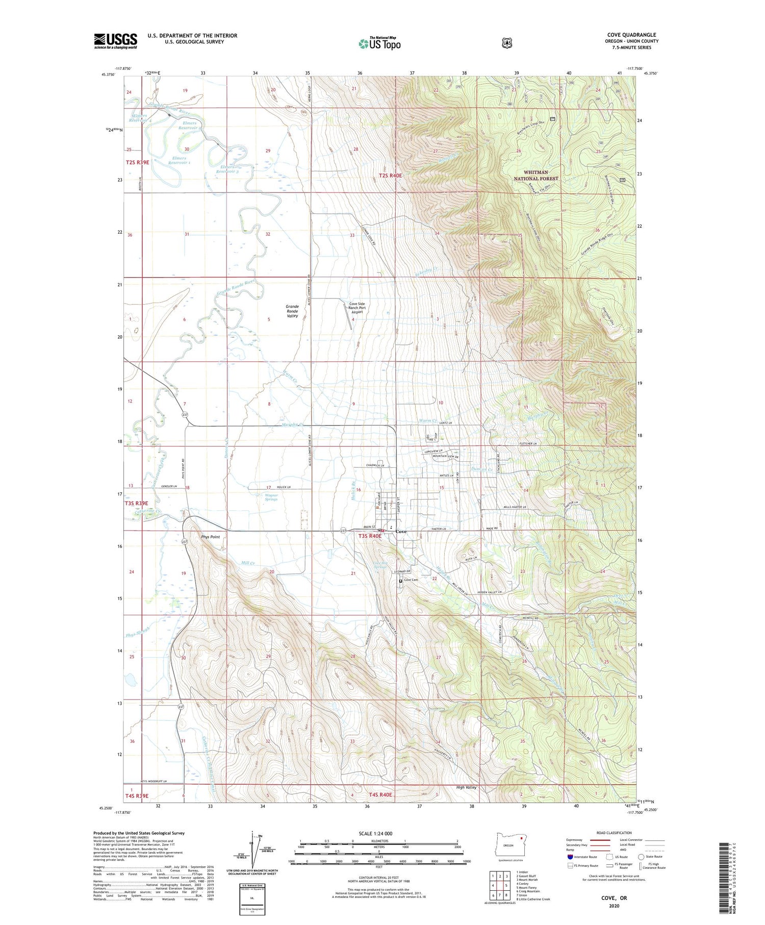
2020 topographic map quadrangle Cove in the state of Oregon. Scale: 1:24000. Based on the newly updated USGS 7.5' US Topo map series, this map is in the following counties: Union. The map contains contour data, water features, and other items you are used to seeing on USGS maps, but also has updated roads and other features. This is the next generation of topographic maps. Printed on high-quality waterproof paper with UV fade-resistant inks.
Quads adjacent to this one:
West: Conley
Northwest: Imbler
North: Gasset Bluff
Northeast: Mount Moriah
East: Mount Fanny
Southeast: Little Catherine Creek
South: Union
Southwest: Craig Mountain
Contains the following named places: Bobington Branch, Boswell Creek, Catherine Creek, City of Cove, Cove, Cove Cemetery, Cove City Hall, Cove Hot Springs, Cove Post Office, Cove Public Library, Cove Rural Fire Protection District, Cove School, Cove Sewer Treatment Plant, Cove Side Ranch Port Airport, Deer Creek, Duncan Creek, Eckesley Creek, Elmer Dam Number Four, Elmer Dam Number Three, Elmers Reservoir 1, Elmers Reservoir 2, Elmers Reservoir 3, Elmers Reservoir 4, Hohstadt Reservoir, Hulick Branch, Mill Creek, Millard Branch, Murphy Creek, Phys Point, Phys Slough, Shanghai School, Spring Creek, Wagner Springs, Warm Creek, ZIP Code: 97824