MyTopo
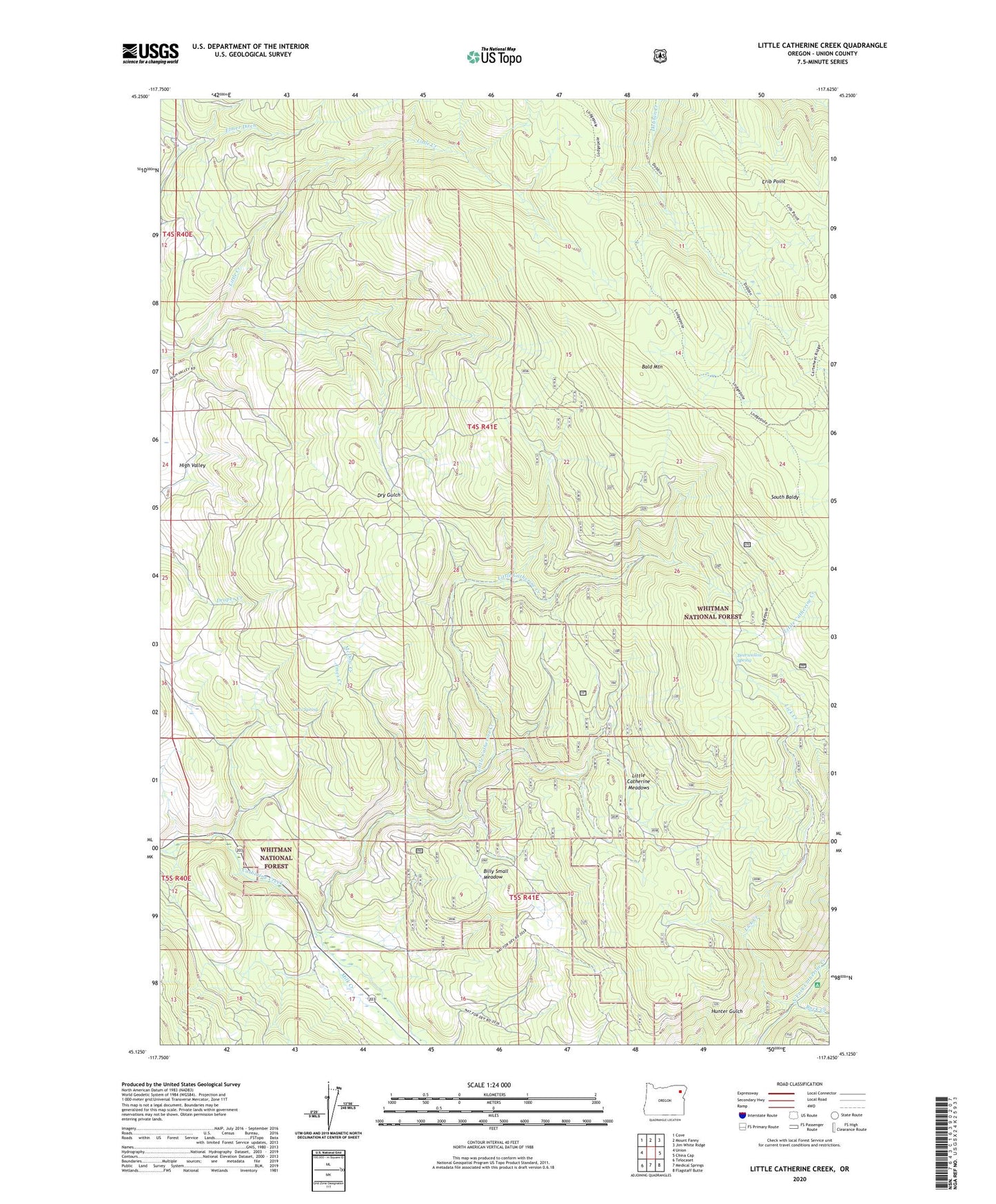
Little Catherine Creek Oregon US Topo Map
Couldn't load pickup availability
Also explore the Little Catherine Creek Forest Service Topo of this same quad for updated USFS data
2023 topographic map quadrangle Little Catherine Creek in the state of Oregon. Scale: 1:24000. Based on the newly updated USGS 7.5' US Topo map series, this map is in the following counties: Union. The map contains contour data, water features, and other items you are used to seeing on USGS maps, but also has updated roads and other features. This is the next generation of topographic maps. Printed on high-quality waterproof paper with UV fade-resistant inks.
Quads adjacent to this one:
West: Union
Northwest: Cove
North: Mount Fanny
Northeast: Jim White Ridge
East: China Cap
Southeast: Flagstaff Butte
South: Medical Springs
Southwest: Telocaset
This map covers the same area as the classic USGS quad with code o45117b6.
Contains the following named places: Ames Creek, Ames Spring, Bald Mountain, Bearwallow Spring, Benson, Billy Small Meadow, Buck Creek, Catherine Creek Guard Station, Catherine Creek State Park, Crib Point, High Valley, Lick Creek, Little Catherine Creek, Little Catherine Meadows, McDow Creek, Milk Creek, South Baldy, Union Division, ZIP Code: 97883