MyTopo
Mount Moriah Oregon US Topo Map
Couldn't load pickup availability
Also explore the Mount Moriah Forest Service Topo of this same quad for updated USFS data
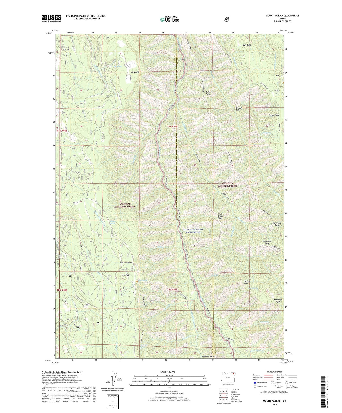
2024 topographic map quadrangle Mount Moriah in the state of Oregon. Scale: 1:24000. Based on the newly updated USGS 7.5' US Topo map series, this map is in the following counties: Union, Wallowa. The map contains contour data, water features, and other items you are used to seeing on USGS maps, but also has updated roads and other features. This is the next generation of topographic maps. Printed on high-quality waterproof paper with UV fade-resistant inks.
Quads adjacent to this one:
West: Gasset Bluff
Northwest: Cricket Flat
North: Minam
Northeast: Wallowa
East: Fox Point
Southeast: Jim White Ridge
South: Mount Fanny
Southwest: Cove
This map covers the same area as the classic USGS quad with code o45117d6.
Contains the following named places: Bluch Creek, Burnt Spring, Chicken Spring, Collusion Point, Cougar Ridge Trail, Coyote Spring, Crooked Trail, Division Gulch, Dunning Creek, Eagle Creek, Elk Point, Faun Creek, Grouse Creek, High Ridge, Horse Basin Creek, Horse Meadow, Jim Spring, Line Bluff, Little Minam River, Lobo Creek, Mahogany Ridge, Monument Point, Moonrise Spring, Mount Moriah, Murphy Creek, Rock Spring, Rock Spring Trail, Trippier Point, Twin Spring