MyTopo
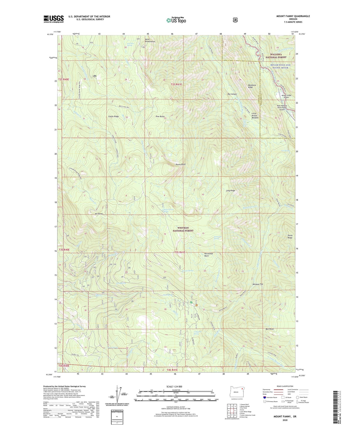
Mount Fanny Oregon US Topo Map
Couldn't load pickup availability
Also explore the Mount Fanny Forest Service Topo of this same quad for updated USFS data
2024 topographic map quadrangle Mount Fanny in the state of Oregon. Scale: 1:24000. Based on the newly updated USGS 7.5' US Topo map series, this map is in the following counties: Union, Wallowa. The map contains contour data, water features, and other items you are used to seeing on USGS maps, but also has updated roads and other features. This is the next generation of topographic maps. Printed on high-quality waterproof paper with UV fade-resistant inks.
Quads adjacent to this one:
West: Cove
Northwest: Gasset Bluff
North: Mount Moriah
Northeast: Fox Point
East: Jim White Ridge
Southeast: China Cap
South: Little Catherine Creek
Southwest: Union
This map covers the same area as the classic USGS quad with code o45117c6.
Contains the following named places: Backbone Ridge, Barrel Spring, Bell Creek, Ben Point, Big Canyon, Boulder Creek, Bridge Creek, Castle Ridge, Dobbin Creek, Dunns Bluff, East Fork Indian Creek, Fireline Creek, Fool Hen Spring, Grizzly Creek, Horseheaven Creek, Horseshoe Basin, Horseshoe Creek, Horseshoe Spring, Huckleberry Creek, Huckleberry Trail, Indian Creek Camp, KTVR-TV, Little Minam Meadow, Lodgepole Spring, Lodgepole Trail, Long Ridge, Lower Falls Little Minam River, Lucky Spring, Minam Lodge, Minam Lodge Airport, Moss Spring, Moss Springs Horse Camp, Moss Springs Recreation Site, Mount Fanny, Mount Fanny Spring, Mount Harris Recreation Site, Pine Butte, Point Prominence, Reds Horse Ranch, Reds Wallowa Horse Ranch Airport, Summit Spring, Threemile Creek, Whiskey Flat, Yew Spring