MyTopo
Welch Butte Oregon US Topo Map
Couldn't load pickup availability
Also explore the Welch Butte Forest Service Topo of this same quad for updated USFS data
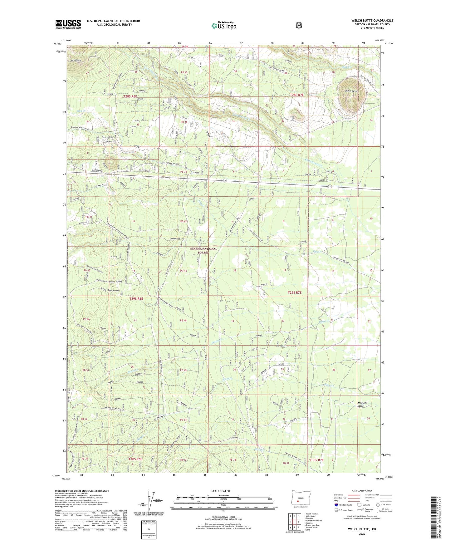
2024 topographic map quadrangle Welch Butte in the state of Oregon. Scale: 1:24000. Based on the newly updated USGS 7.5' US Topo map series, this map is in the following counties: Klamath. The map contains contour data, water features, and other items you are used to seeing on USGS maps, but also has updated roads and other features. This is the next generation of topographic maps. Printed on high-quality waterproof paper with UV fade-resistant inks.
Quads adjacent to this one:
West: Pumice Desert East
Northwest: Mount Thielsen
North: Miller Lake
Northeast: Chemult
East: Mazama
Southeast: Lenz
South: Pothole Butte
Southwest: Crater Lake East
This map covers the same area as the classic USGS quad with code o43121a8.
Contains the following named places: Bear Creek, Cottonwood Creek, Tiny Creek, Welch Butte