MyTopo
Crawfish Lake Oregon US Topo Map
Couldn't load pickup availability
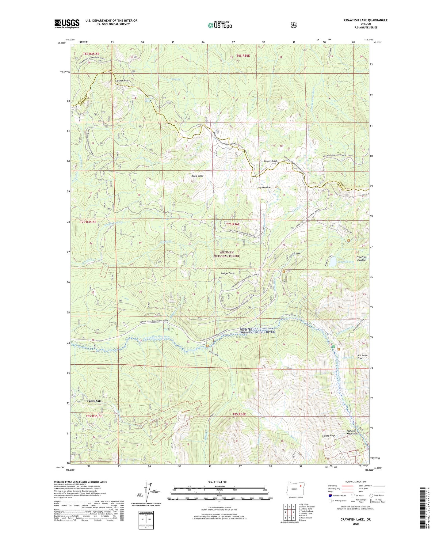
2020 topographic map quadrangle Crawfish Lake in the state of Oregon. Scale: 1:24000. Based on the newly updated USGS 7.5' US Topo map series, this map is in the following counties: Grant, Union. The map contains contour data, water features, and other items you are used to seeing on USGS maps, but also has updated roads and other features. This is the next generation of topographic maps. Printed on high-quality waterproof paper with UV fade-resistant inks.
Quads adjacent to this one:
West: Trout Meadows
Northwest: Fly Valley
North: Limber Jim Creek
Northeast: Anthony Butte
East: Anthony Lakes
Southeast: Bourne
South: Mount Ireland
Southwest: Granite
Contains the following named places: Baby McKee Mine, Badger Butte, Baldy Creek, Bill Brown Cove, Black Butte, Bull Creek, Cabell City, Chicken Hill, Continental Mine, Crawfish Creek, Crawfish Lake, Cunningham Creek, French Diggings, Hoodoo Creek, Labellevue Mine, Limber Creek, Loa Mae Mine, Long Meadow, Long Meadow Creek, Lookout Spring, Middle Trail Creek, North Fork Meadow, Peavy Cabin, Peavy Cabin Recreation Site, Peavy Creek, Standard Mine, Whitman National Forest