MyTopo
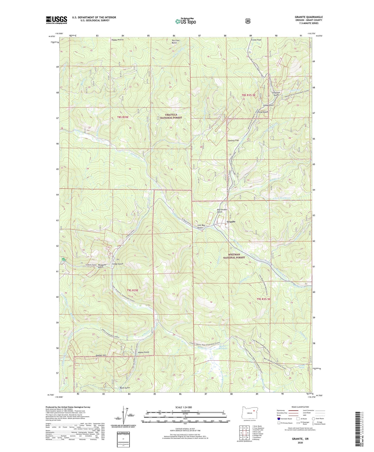
Granite Oregon US Topo Map
Couldn't load pickup availability
Also explore the Granite Forest Service Topo of this same quad for updated USFS data
2024 topographic map quadrangle Granite in the state of Oregon. Scale: 1:24000. Based on the newly updated USGS 7.5' US Topo map series, this map is in the following counties: Grant. The map contains contour data, water features, and other items you are used to seeing on USGS maps, but also has updated roads and other features. This is the next generation of topographic maps. Printed on high-quality waterproof paper with UV fade-resistant inks.
Quads adjacent to this one:
West: Olive Lake
Northwest: Silver Butte
North: Trout Meadows
Northeast: Crawfish Lake
East: Mount Ireland
Southeast: Whitney
South: Greenhorn
Southwest: Vinegar Hill
This map covers the same area as the classic USGS quad with code o44118g4.
Contains the following named places: Ajax Mine, Alamo, Alamo Gulch, Alamo Mine, Alamo Post Office, Beaver Creek, Beaver Meadows, Big Four Mine, Big Gordon Gulch, Blackjack Mine, Blue Mountain Mine, Blue Ribbon Mine, Bluebird Mine, Boston Tunnel, Boulder Creek, Buck Creek, Buck Gulch, Buffalo Mine, Bull Run Creek, Butcher Boy Mine, China Gulch, Chipman Gulch, City of Granite, Clear Creek, Congo Gulch, Corral Creek, Corrigal Spring, Corrigal Spring Campground, Cougar Mine, Cox Tunnels, Crane Flats Forest Service Station, Dry Creek, East Ten Cent Creek, Fremont Powerhouse, Golars Goat Trail, Granite, Granite City Hall, Granite Post Office, Granite Roadmaster Office, Gray Eagle Mine, Gutridge Creek, Happy Prairie, Humpback Mine, Independence Mine, Jay Bird Mine, Kuckuc Creek, Lamb Creek, Last Chance Creek, Lawton, Lawton Post Office, Lightning Creek, Lightning Creek Placers, Little Blue Mine, Lon Krise Cabin, Lost Boy Gulch, Lost Buck Mine, Lucas Gulch, Magnolia Mine, May Queen Mine, Mineral Wonder Mine, Mosquito Gulch, New York Mine, North Fork Ruby Creek, Olive Creek, Pasture Creek, Poor Boy Mine, Porterville, Quebec Hill, Quebec Mine, Red Boy Mine, Red Mountain Mine, Redboy Post Office, Ruby Creek, Ruby Creek Mines, Sawmill Flat, Scandia Tunnel, South Fork Beaver Creek, South Fork Boulder Creek, South Fork Ruby Creek, Strasburg Mine, Tabor Diggings, Ten Cent Butte, Ten Cent Creek, Tencent Placer Mine, Tillicum Mine, Van Anda Mine, West Ten Cent Creek, Yellowstone Mine