MyTopo
Bourne Oregon US Topo Map
Couldn't load pickup availability
Also explore the Bourne Forest Service Topo of this same quad for updated USFS data
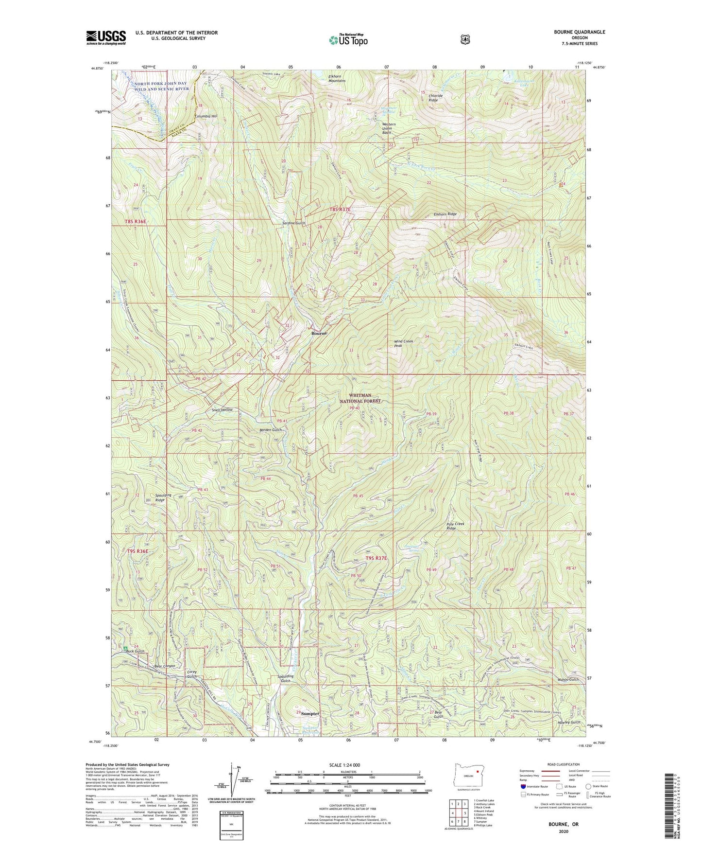
2024 topographic map quadrangle Bourne in the state of Oregon. Scale: 1:24000. Based on the newly updated USGS 7.5' US Topo map series, this map is in the following counties: Baker, Grant. The map contains contour data, water features, and other items you are used to seeing on USGS maps, but also has updated roads and other features. This is the next generation of topographic maps. Printed on high-quality waterproof paper with UV fade-resistant inks.
Quads adjacent to this one:
West: Mount Ireland
Northwest: Crawfish Lake
North: Anthony Lakes
Northeast: Rock Creek
East: Elkhorn Peak
Southeast: Phillips Lake
South: Sumpter
Southwest: Whitney
This map covers the same area as the classic USGS quad with code o44118g2.
Contains the following named places: Amazon Mine, Analulu Mine, Argonaut Mine, Bear Canyon, Borden Gulch, Bourne, Bourne Post Office, Brooklyn Mine, Buck Gulch, Buckeye Mine, Bunker Hill Mine, Chloride Mine, Chloride Post Office, Chloride Ridge, Cleveland, Columbia Hill, Columbia Mine, Corey Gulch, Cracker Camp, Cracker City, Cracker Post Office, E and E Mine, East Fork Pole Creek, Esmeralda Mine, Eureka Post Office, Flowing Well, Fruit Creek, Golconda Mine, Hanover, Hanover Post Office, Horse Creek, Kelly Mine, Killamacue Lake, Little Cracker Creek, Mayflower Meadow, McCully Recreation Site, Molly Gibson Mine, Morning Star Mine, Mountain Belle Mine, Mountain View Mine, North Fork Rock Creek, North Pole Mine, Pinegrass Spring, Pole Creek, Pole Creek Camp, Pole Creek Ridge, Rock Creek Lake Trail, Sardine Gulch, Sheep Creek, Silver Creek, Silver Creek Camp, Silver Dick Mine, Slim Creek, Snell Hollow, South Pole Mine, Spaulding Gulch, Spaulding Ridge, Sumpter Reservoir, Wahoo Gulch, Western Union Basin, Western Union Mine, Wind Creek, Wind Creek Peak