MyTopo
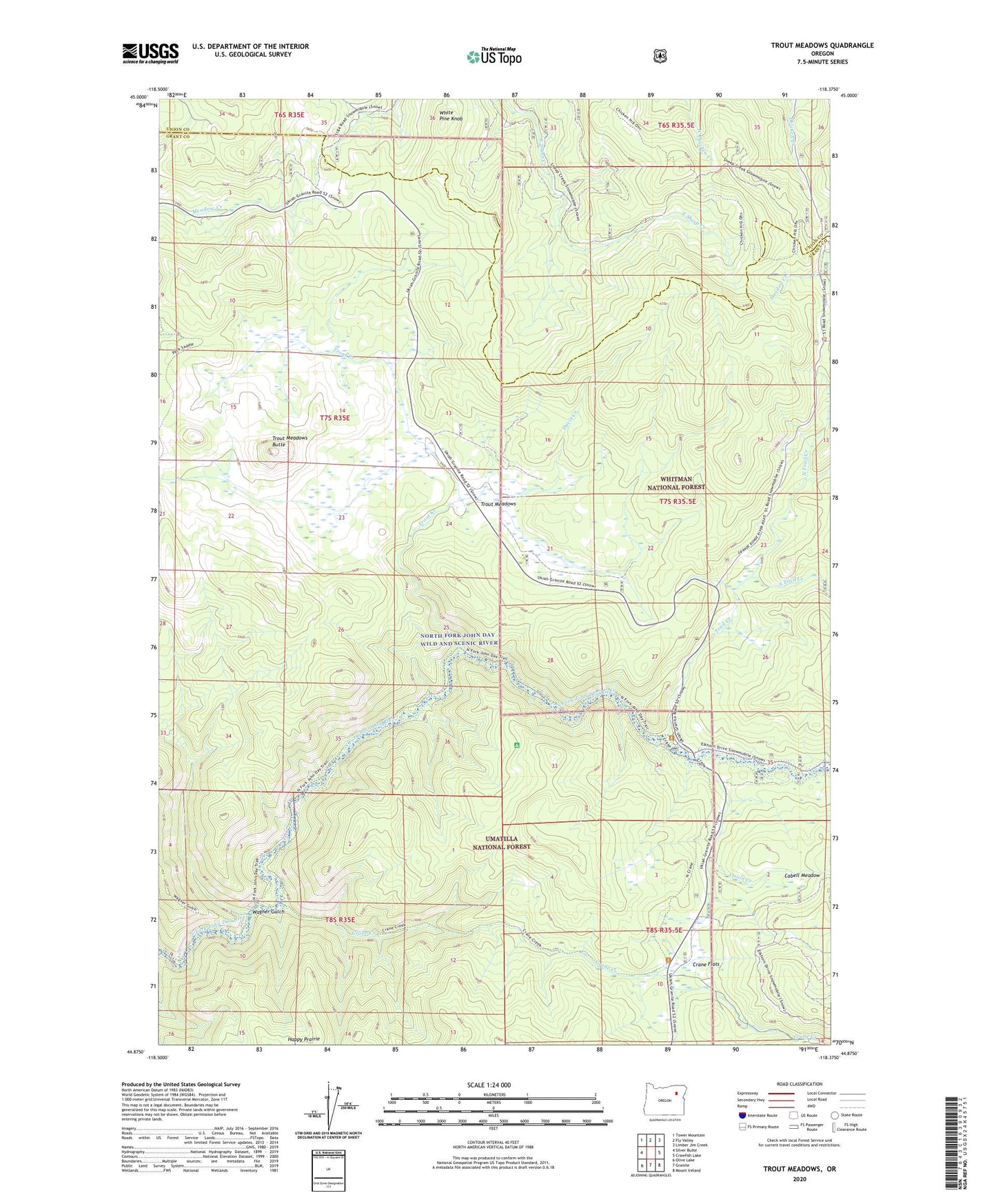
Trout Meadows Oregon US Topo Map
Couldn't load pickup availability
Also explore the Trout Meadows Forest Service Topo of this same quad for updated USFS data
2024 topographic map quadrangle Trout Meadows in the state of Oregon. Scale: 1:24000. Based on the newly updated USGS 7.5' US Topo map series, this map is in the following counties: Grant, Union. The map contains contour data, water features, and other items you are used to seeing on USGS maps, but also has updated roads and other features. This is the next generation of topographic maps. Printed on high-quality waterproof paper with UV fade-resistant inks.
Quads adjacent to this one:
West: Silver Butte
Northwest: Tower Mountain
North: Fly Valley
Northeast: Limber Jim Creek
East: Crawfish Lake
Southeast: Mount Ireland
South: Granite
Southwest: Olive Lake
This map covers the same area as the classic USGS quad with code o44118h4.
Contains the following named places: Cabell Meadow, Crane Creek, Crane Flats, Davis Creek, Klopp Placer Mine, North Fork John Day Recreation Site, North Trail Creek, Onion Creek, South Trail Creek, Thornburg Placer Mine, Trail Creek, Trout Creek, Trout Meadows, Trout Meadows Butte, Wagner Gulch, White Pine Knob