MyTopo
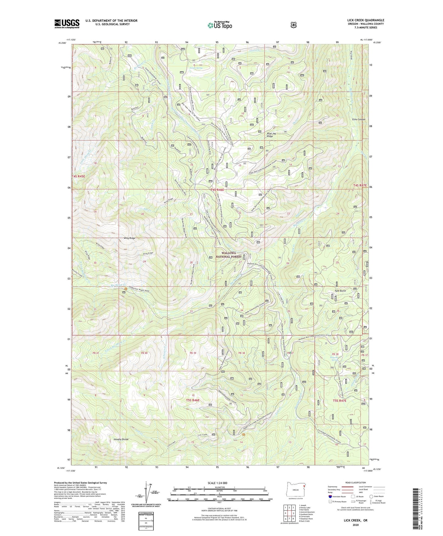
Lick Creek Oregon US Topo Map
Couldn't load pickup availability
Also explore the Lick Creek Forest Service Topo of this same quad for updated USFS data
2024 topographic map quadrangle Lick Creek in the state of Oregon. Scale: 1:24000. Based on the newly updated USGS 7.5' US Topo map series, this map is in the following counties: Wallowa. The map contains contour data, water features, and other items you are used to seeing on USGS maps, but also has updated roads and other features. This is the next generation of topographic maps. Printed on high-quality waterproof paper with UV fade-resistant inks.
Quads adjacent to this one:
West: Aneroid Mountain
Northwest: Joseph
North: Kinney Lake
Northeast: Harl Butte
East: Gumboot Butte
Southeast: Duck Creek
South: Deadman Point
Southwest: Cornucopia
This map covers the same area as the classic USGS quad with code o45117b1.
Contains the following named places: Blue Jay Ridge, Cabin Creek, Copper Mountain Mine, Echo Canyon, Hass Creek, Johnson Creek, Lick Creek, Lick Creek Ranger Station, Lick Creek Recreation Site, Lick Creek Trailhead, Lost Lake, Middle Fork Big Sheep Creek, Mud Spring Creek, Nebo Lookout, North Fork Big Sheep Creek, Salt Creek, Salt Creek Summit Sno-Park, South Fork Big Sheep Creek, Target Spring, Tenderfoot Trailhead, Tyee Butte, Tyee Creek, Wagon Road Trailhead, Wallowa-Whitman National Forest, Wayside Spring, Wayside Springs Forest Camp, Zollman and Wells Mine