MyTopo
Dee Oregon US Topo Map
Couldn't load pickup availability
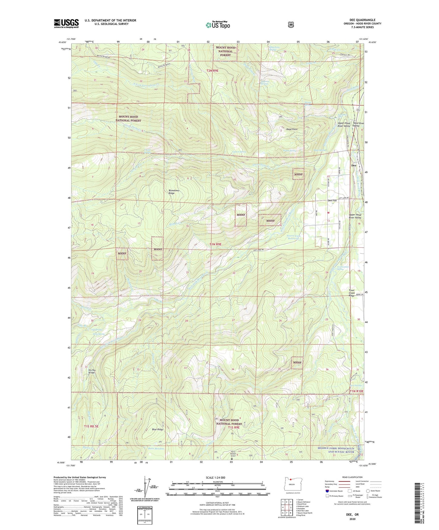
2020 topographic map quadrangle Dee in the state of Oregon. Scale: 1:24000. Based on the newly updated USGS 7.5' US Topo map series, this map is in the following counties: Hood River. The map contains contour data, water features, and other items you are used to seeing on USGS maps, but also has updated roads and other features. This is the next generation of topographic maps. Printed on high-quality waterproof paper with UV fade-resistant inks.
Quads adjacent to this one:
West: Wahtum Lake
Northwest: Carson
North: Mount Defiance
Northeast: Hood River
East: Parkdale
Southeast: Dog River
South: Mount Hood North
Southwest: Bull Run Lake
Contains the following named places: Batts Meadow, Birdie Creek, Blowdown Ridge, Camp Creek, Capron Spring, Cedar Branch, Cold Springs, Crystal Springs, Dago Spring, Dead Point, Dead Point Creek, Dead Point Spring, Dee, Dee Division, Dee Flat, Dee Flat Ditch, Dee Flat Guard Station, Dee Flat Seed Orchard, Dee Post Office, Dee Rural Fire Protection District, Divers Creek, Dry Run, Dry Run Bridge, East Fork Hood River, Gate Creek, Green Point Creek, Harry Wollam Grave, Hood River County, Hood River Hatchery, Ice Fountain Spring, Japanese Springs, Lake Branch, Laurel Creek, Lava Springs, Little Creek, Long Branch Creek, Low Line Ditch, Middle Fork Hood River, Mosquito Creek, North Fork Green Point Creek, Oak Grove Ditch, Punchbowl Falls, Savage Springs, Searra Casa Reservoir, Shingle Creek, South Pine Creek, Stone Spring, Tony Creek, Upper Hood River Valley, West Fork Hood River, Winan Spring, Winans