MyTopo
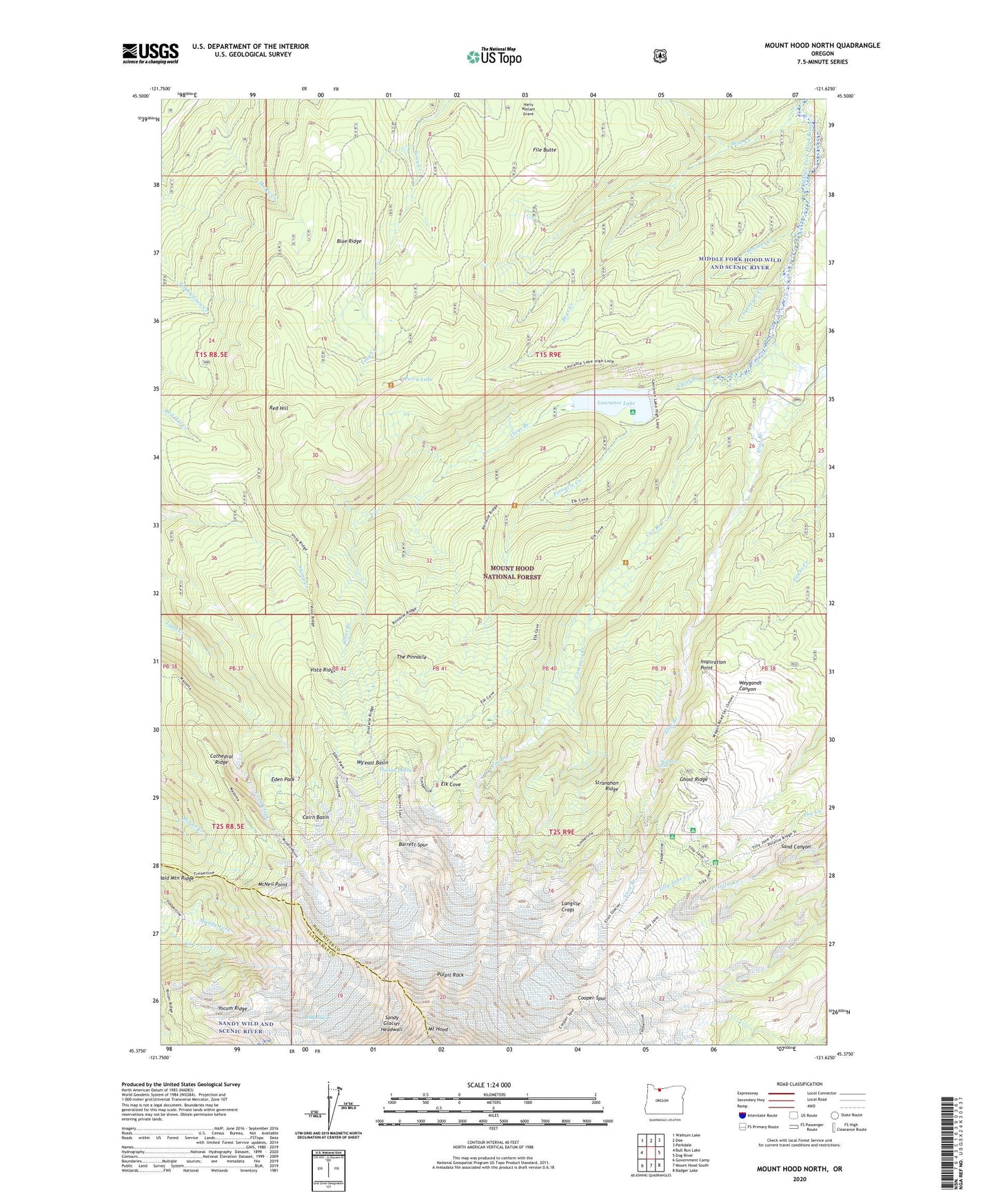
Mount Hood North Oregon US Topo Map
Couldn't load pickup availability
Also explore the Mount Hood North Forest Service Topo of this same quad for updated USFS data
2024 topographic map quadrangle Mount Hood North in the state of Oregon. Scale: 1:24000. Based on the newly updated USGS 7.5' US Topo map series, this map is in the following counties: Hood River, Clackamas. The map contains contour data, water features, and other items you are used to seeing on USGS maps, but also has updated roads and other features. This is the next generation of topographic maps. Printed on high-quality waterproof paper with UV fade-resistant inks.
Quads adjacent to this one:
West: Bull Run Lake
Northwest: Wahtum Lake
North: Dee
Northeast: Parkdale
East: Dog River
Southeast: Badger Lake
South: Mount Hood South
Southwest: Government Camp
This map covers the same area as the classic USGS quad with code o45121d6.
Contains the following named places: Bald Mountain Ridge, Barrett Spur, Bear Creek, Blue Ridge, Boomer Creek, Cairn Basin, Cathedral Ridge, Clear Branch, Clear Branch Dam, Cloud Cap Inn, Cloud Cap Saddle Recreation Site, Cloud Cap-Tilly Jane Historic Area, Coe Branch, Coe Glacier, Compass Creek, Cooper Spur, Cooper Spur Ski Trail, Dollar Lake, Dollar Quarry, Eden Park, Eliot Branch, Eliot Glacier, Elk Cove, Elk Grove Trail, File Butte, Ghost Ridge, Glisan Glacier, Inspiration Point, Kinnikinnick Recreation Site, Ladd Glacier, Langille Crags, Langille Glacier, Laurance Lake, Laurance Lake Boat Ramp, McNeil Point, Middle Fork Hood Wild and Scenic River, Perry Lake, Pinnacle Creek, Pinnacle Ridge Trail, Pulpit Rock, Recession Lakes, Red Hill, Red Hill Guard Station, Reservoir Campground, Sandy Glacier, Sandy Glacier Headwall, Squeegee Creek, Stranahan Ridge, Stump Creek Trail, The Pinnacle, Tilly Jane Guard Station, Tilly Jane Recreation Site, Tilly Jane Trail, Timberline Trail, Vista Ridge, Vista Ridge Trail, Wallalute Falls, Wy'east Basin