MyTopo
Deep Creek Oregon US Topo Map
Couldn't load pickup availability
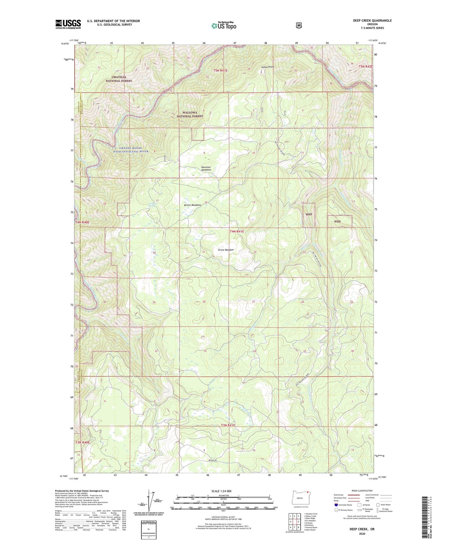
2020 topographic map quadrangle Deep Creek in the state of Oregon. Scale: 1:24000. Based on the newly updated USGS 7.5' US Topo map series, this map is in the following counties: Wallowa, Union. The map contains contour data, water features, and other items you are used to seeing on USGS maps, but also has updated roads and other features. This is the next generation of topographic maps. Printed on high-quality waterproof paper with UV fade-resistant inks.
Quads adjacent to this one:
West: Fry Meadow
Northwest: Wenaha Forks
North: Elbow Creek
Northeast: Eden Ridge
East: Promise
Southeast: Akers Butte
South: Howard Butte
Southwest: Rondowa
Contains the following named places: Alder Creek, Brown Meadows, Clear Creek, Deep Creek, East Grossman Creek, Ferguson Spring, Grande Ronde Scenic Area, Grossman Creek, Grove Meadow, Indian Point, Minam State Park, Newman Meadows, Wenaka Post Office