MyTopo
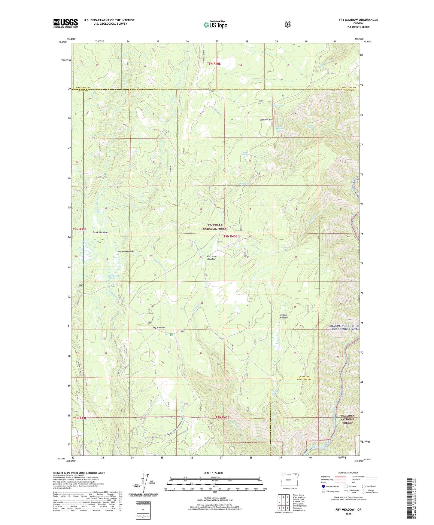
Fry Meadow Oregon US Topo Map
Couldn't load pickup availability
Also explore the Fry Meadow Forest Service Topo of this same quad for updated USFS data
2024 topographic map quadrangle Fry Meadow in the state of Oregon. Scale: 1:24000. Based on the newly updated USGS 7.5' US Topo map series, this map is in the following counties: Union, Wallowa. The map contains contour data, water features, and other items you are used to seeing on USGS maps, but also has updated roads and other features. This is the next generation of topographic maps. Printed on high-quality waterproof paper with UV fade-resistant inks.
Quads adjacent to this one:
West: Jubilee Lake
Northwest: Bone Spring
North: Wenaha Forks
Northeast: Elbow Creek
East: Deep Creek
Southeast: Howard Butte
South: Rondowa
Southwest: Partridge Creek
This map covers the same area as the classic USGS quad with code o45117g7.
Contains the following named places: Alder Spring, Bear Canyon Campground, Brock Meadows, Deer Spring, Fry Meadow, Fry Meadow Creek, Fry Meadow Guard Station, Jarboe Meadow, Jaussaud Corral, Kettleson Meadow, Lookout Mountain, Lookout Mountain Spring, Lookout Tower, Meadow Creek, Pearson Cabin, Pinical Spring, Proctor Creek, Pyles Canyon Dam Number Two, Sheepherder Spring, Sweikert Ranch, Swikert Meadow, Tin Can Spring