MyTopo
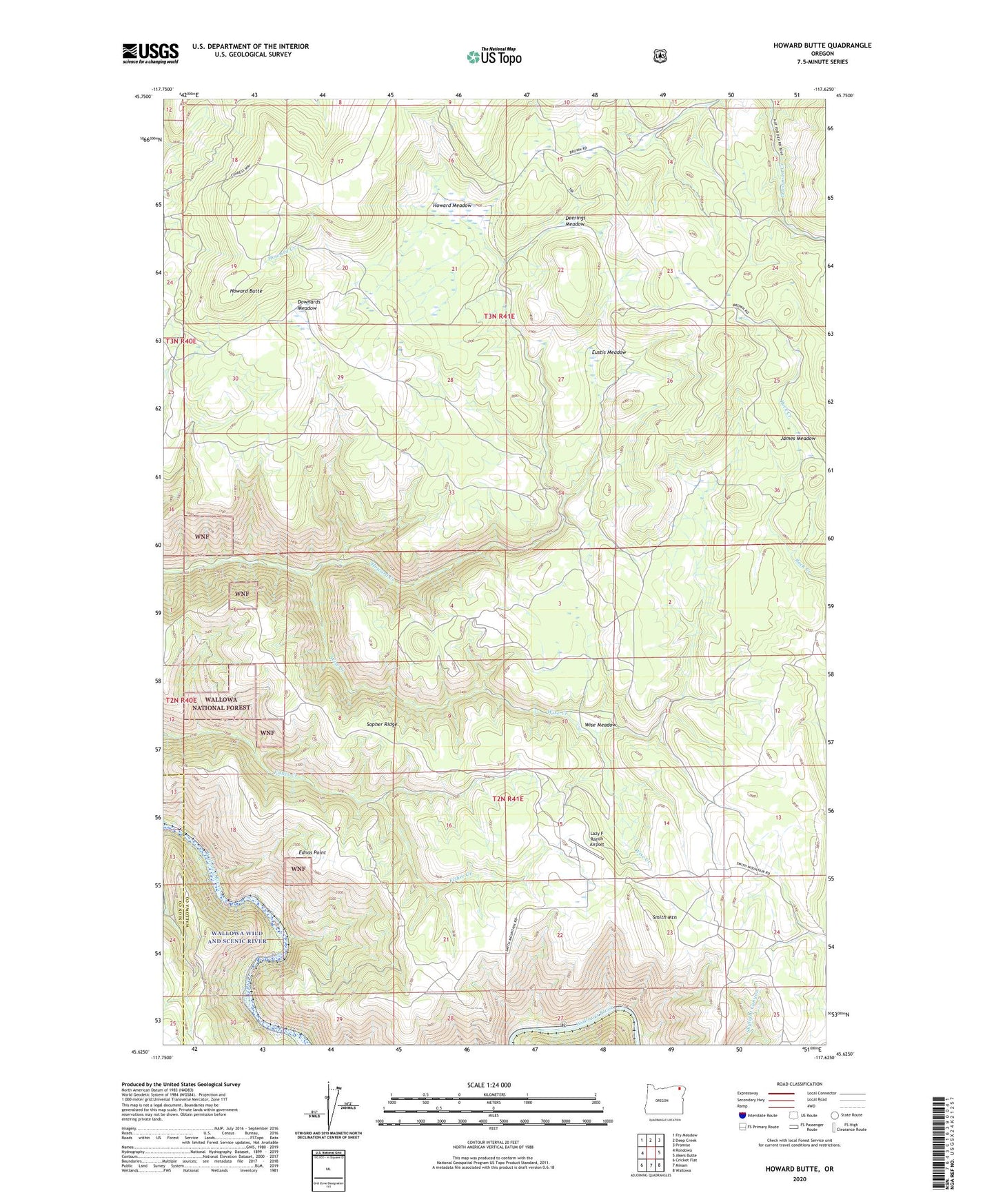
Howard Butte Oregon US Topo Map
Couldn't load pickup availability
Also explore the Howard Butte Forest Service Topo of this same quad for updated USFS data
2024 topographic map quadrangle Howard Butte in the state of Oregon. Scale: 1:24000. Based on the newly updated USGS 7.5' US Topo map series, this map is in the following counties: Wallowa, Union. The map contains contour data, water features, and other items you are used to seeing on USGS maps, but also has updated roads and other features. This is the next generation of topographic maps. Printed on high-quality waterproof paper with UV fade-resistant inks.
Quads adjacent to this one:
West: Rondowa
Northwest: Fry Meadow
North: Deep Creek
Northeast: Promise
East: Akers Butte
Southeast: Wallowa
South: Minam
Southwest: Cricket Flat
This map covers the same area as the classic USGS quad with code o45117f6.
Contains the following named places: Camp Five, Coal Docks, Deerings Meadow, Downards Meadow, Ednas Point, Eustis, Eustis Meadow, Eustis Post Office, Howard Butte, Howard Meadow, James Meadow, Lazy F Ranch Airport, Lovely Post Office, Smith Mountain, Sopher Ridge, Vincent Post Office, Wise Creek, Wise Meadow