MyTopo
Deer Flat Oregon US Topo Map
Couldn't load pickup availability
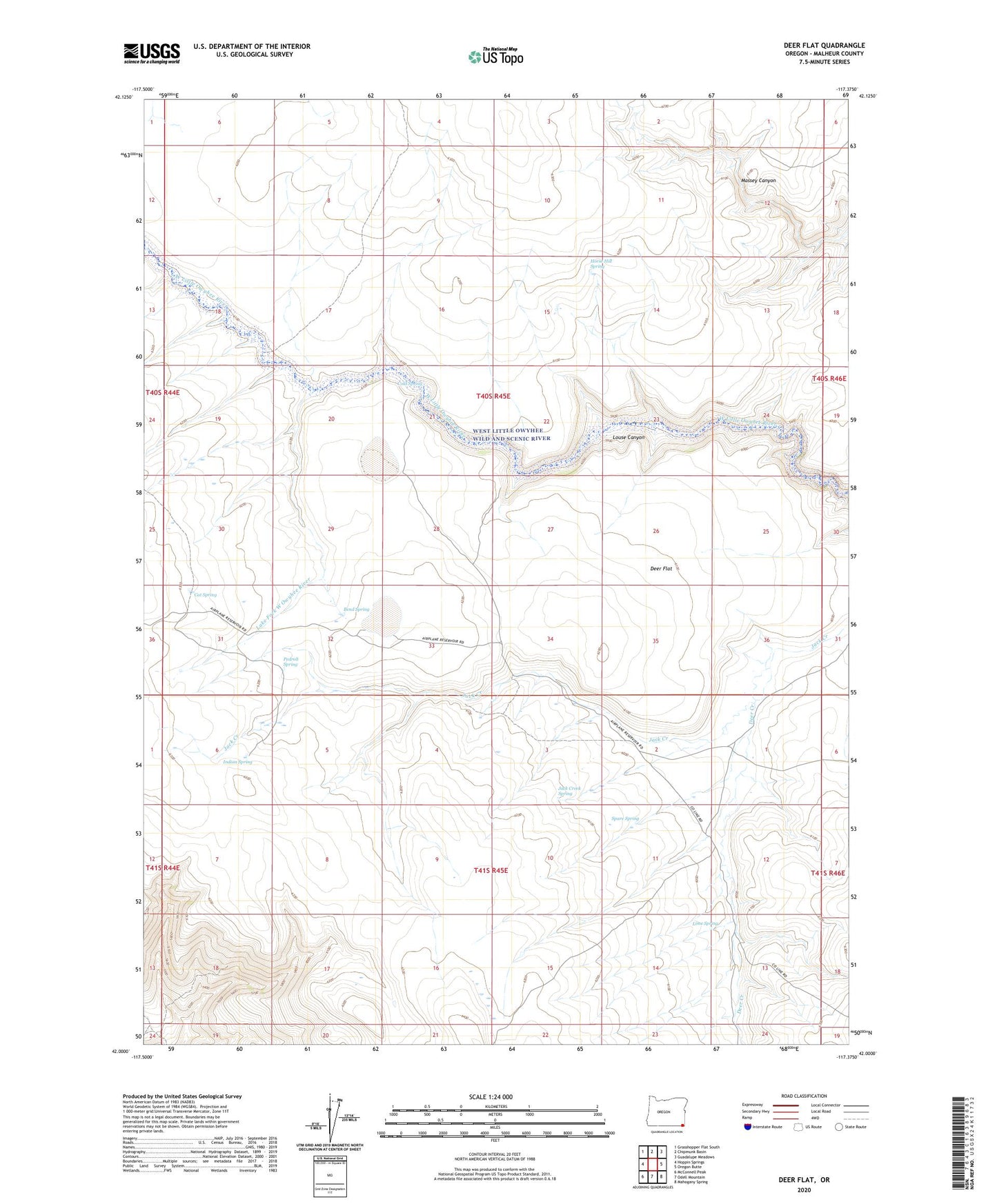
2024 topographic map quadrangle Deer Flat in the state of Oregon. Scale: 1:24000. Based on the newly updated USGS 7.5' US Topo map series, this map is in the following counties: Malheur. The map contains contour data, water features, and other items you are used to seeing on USGS maps, but also has updated roads and other features. This is the next generation of topographic maps. Printed on high-quality waterproof paper with UV fade-resistant inks.
Quads adjacent to this one:
West: Hoppin Springs
Northwest: Grasshopper Flat South
North: Chipmunk Basin
Northeast: Guadalupe Meadows
East: Oregon Butte
Southeast: Mahogany Spring
South: Odell Mountain
Southwest: McConnell Peak
This map covers the same area as the classic USGS quad with code o42117a4.
Contains the following named places: Andersons Corral, Bend Spring, Cat Spring, Cold Spring, Deer Creek, Deer Flat, Horse Hill Spring, Indian Spring, Jack Creek Spring, Lake Fork West Owyhee River, Lime Spring, Pedroli Spring, Spare Spring