MyTopo
Guadalupe Meadows Oregon US Topo Map
Couldn't load pickup availability
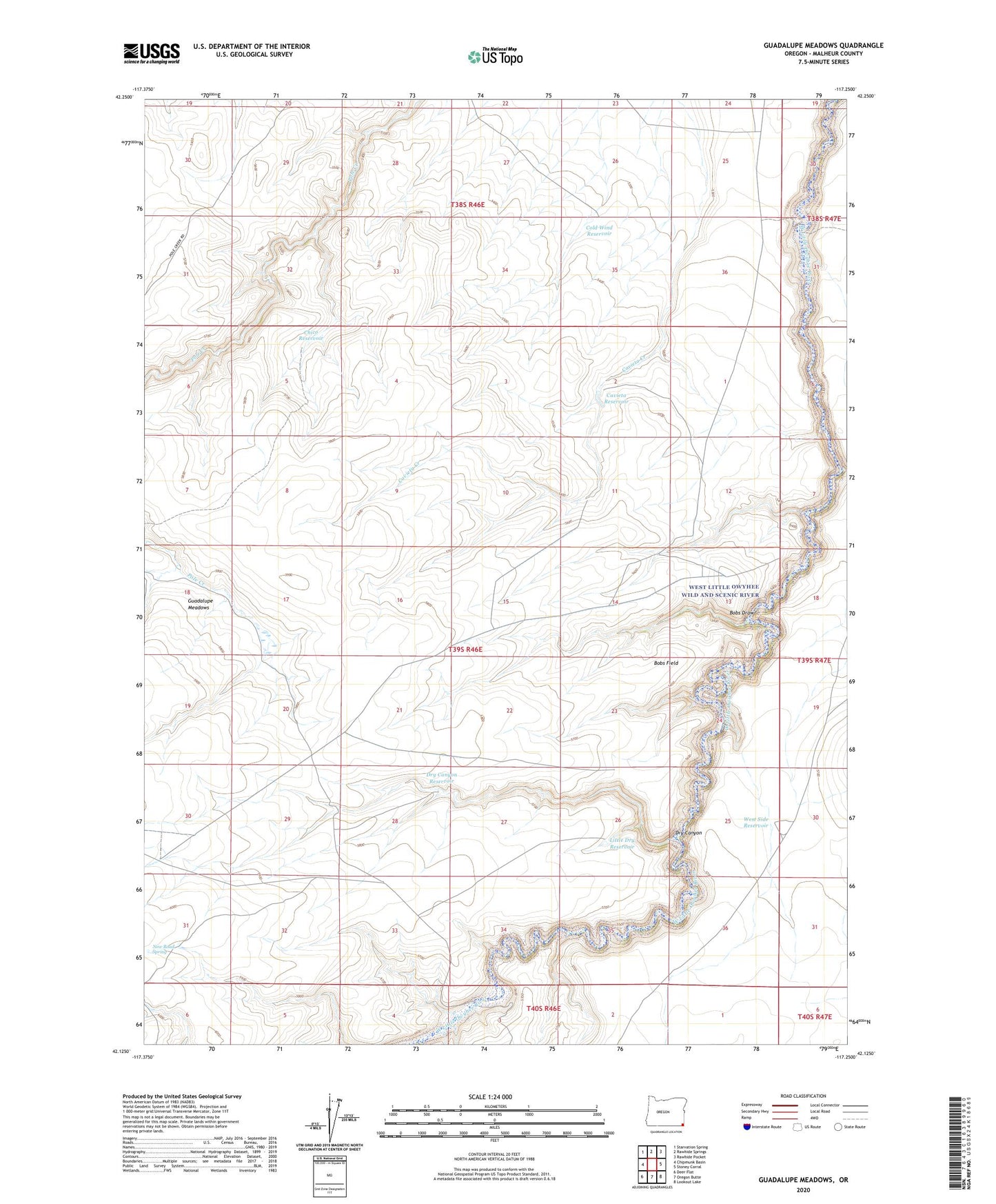
2024 topographic map quadrangle Guadalupe Meadows in the state of Oregon. Scale: 1:24000. Based on the newly updated USGS 7.5' US Topo map series, this map is in the following counties: Malheur. The map contains contour data, water features, and other items you are used to seeing on USGS maps, but also has updated roads and other features. This is the next generation of topographic maps. Printed on high-quality waterproof paper with UV fade-resistant inks.
Quads adjacent to this one:
West: Chipmunk Basin
Northwest: Starvation Spring
North: Rawhide Springs
Northeast: Rawhide Pocket
East: Stoney Corral
Southeast: Lookout Lake
South: Oregon Butte
Southwest: Deer Flat
This map covers the same area as the classic USGS quad with code o42117b3.
Contains the following named places: Anderson Crossing, Bobs Draw, Bobs Field, Castro Corral, Cavieta Reservoir, Chico Reservoir, Cold Wind Reservoir, Dry Canyon, Dry Canyon Reservoir, Flag Crossing, Guadalupe Meadows, Little Dry Reservoir, New Road Spring, West Little Owyhee Wild and Scenic River, West Side Reservoir