MyTopo
Depoe Bay Oregon US Topo Map
Couldn't load pickup availability
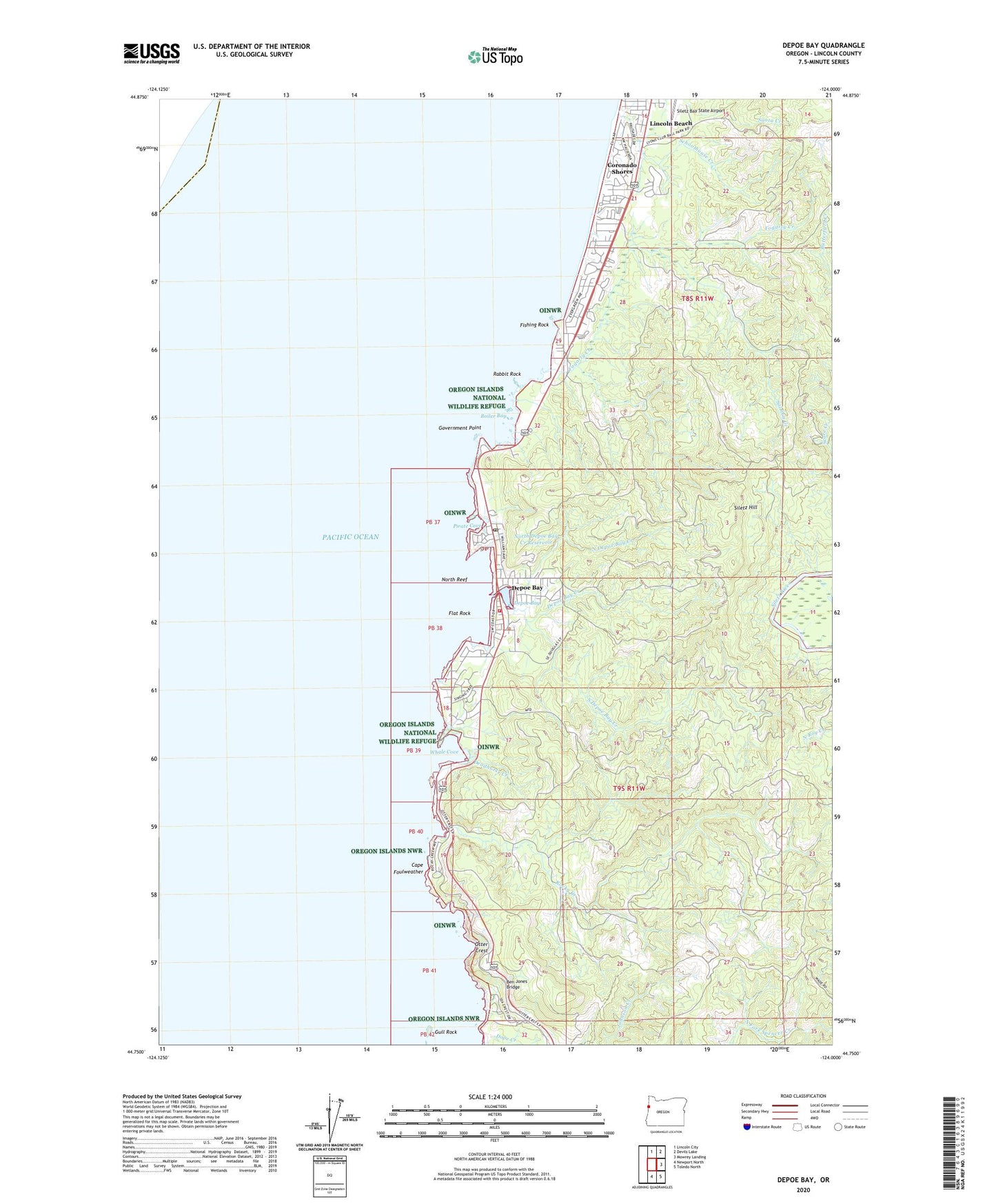
2024 topographic map quadrangle Depoe Bay in the state of Oregon. Scale: 1:24000. Based on the newly updated USGS 7.5' US Topo map series, this map is in the following counties: Lincoln. The map contains contour data, water features, and other items you are used to seeing on USGS maps, but also has updated roads and other features. This is the next generation of topographic maps. Printed on high-quality waterproof paper with UV fade-resistant inks.
Quads adjacent to this one:
North: Lincoln City
Northeast: Devils Lake
East: Mowrey Landing
Southeast: Toledo North
South: Newport North
This map covers the same area as the classic USGS quad with code o44124g1.
Contains the following named places: Ben Jones Bridge, Boiler Bay, Boiler Bay State Park, Briggs Landing, Cape Foulweather, City of Depoe Bay, Coronado Shores, Deadhorse Creek, Depoe Bay, Depoe Bay City Hall, Depoe Bay City Park, Depoe Bay Creek, Depoe Bay Harbor, Depoe Bay Post Office, Depoe Bay Public Works, Depoe Bay Rural Fire Protection District Station 2300 Depoe Bay, Depoe Bay Wastewater Treatment Plant, Depoe Bay Water Treatment Plant, Dope Creek, Finger Rock, Fishing Rock, Fishing Rock State Park, Flat Rock, Fogarty Creek, Fogarty Creek State Park, Government Point, Gull Rock, H2O and S Sewage Disposal, Imperial Marine Services Boat Ramp, KNPT-FM, Lincoln Beach, Lincoln Beach Post Office, Lincoln Beach Wayside, North Depoe Bay Creek, North Depoe Bay Creek Reservoir, North Reef, Otter Crest, Otter Crest Rest Area, Otter Crest State Park, Pacific Palisades, Pirate Cove, Rabbit Rock, Rocky Creek, Rocky Creek State Park, Sabre Creek, Salmon Creek, Schoolhouse Creek, Siletz Hill, South Depoe Bay Creek, United States Coast Guard Motor Lifeboat Station Depoe Bay, Whale Cove, Whale Watching Center, Williams Creek, ZIP Codes: 97341, 97369