MyTopo
Diamond Swamp Oregon US Topo Map
Couldn't load pickup availability
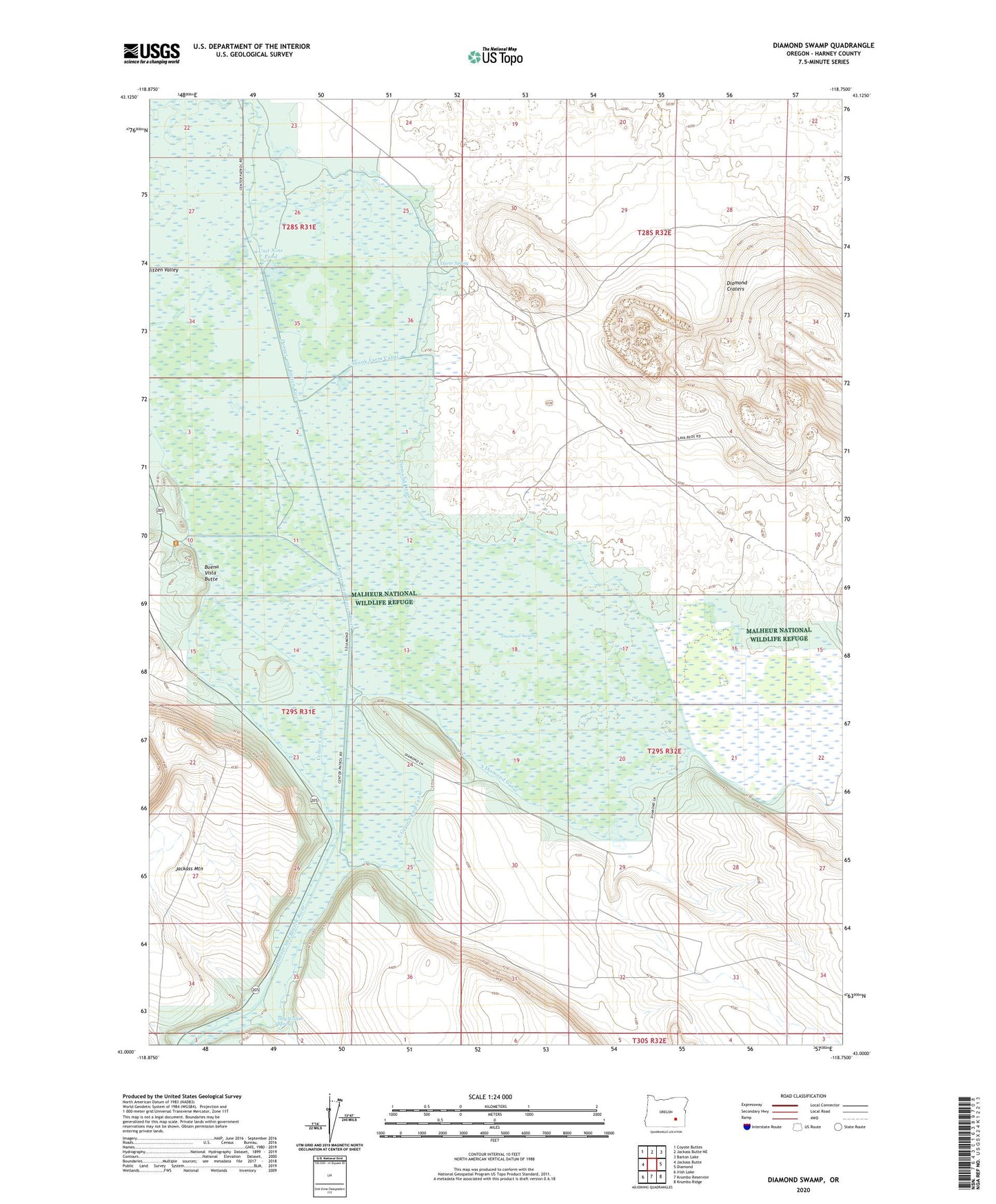
2023 topographic map quadrangle Diamond Swamp in the state of Oregon. Scale: 1:24000. Based on the newly updated USGS 7.5' US Topo map series, this map is in the following counties: Harney. The map contains contour data, water features, and other items you are used to seeing on USGS maps, but also has updated roads and other features. This is the next generation of topographic maps. Printed on high-quality waterproof paper with UV fade-resistant inks.
Quads adjacent to this one:
West: Jackass Butte
Northwest: Coyote Buttes
North: Jackass Butte NE
Northeast: Barton Lake
East: Diamond
Southeast: Krumbo Ridge
South: Krumbo Reservoir
Southwest: Irish Lake
This map covers the same area as the classic USGS quad with code o43118a7.
Contains the following named places: Anderson Ranch, Buena Vista Butte, Buena Vista Patrol Station, Center Canal, Diamond Craters, Diamond Drain, Diamond Swamp, East Grain Camp Canal, Grain Camp, Grain Camp Dam, Hog Wallow Spring, Oliver Spring, Skunk Farm Canal, South Diamond Canal, Unit Nine Pond