MyTopo
Irish Lake Oregon US Topo Map
Couldn't load pickup availability
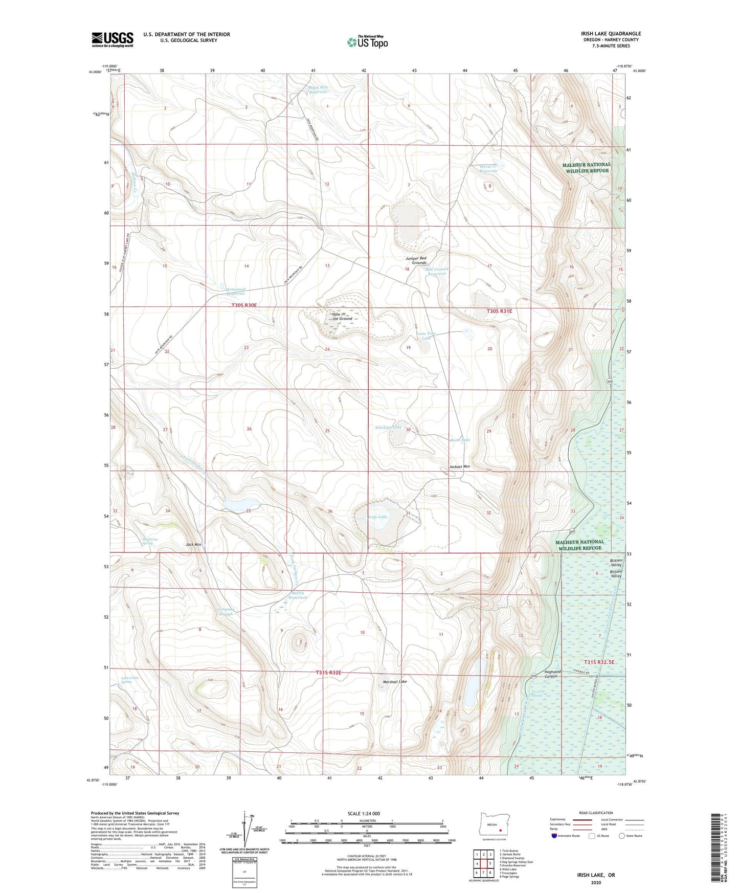
2023 topographic map quadrangle Irish Lake in the state of Oregon. Scale: 1:24000. Based on the newly updated USGS 7.5' US Topo map series, this map is in the following counties: Harney. The map contains contour data, water features, and other items you are used to seeing on USGS maps, but also has updated roads and other features. This is the next generation of topographic maps. Printed on high-quality waterproof paper with UV fade-resistant inks.
Quads adjacent to this one:
West: Keg Springs Valley East
Northwest: Twin Buttes
North: Jackass Butte
Northeast: Diamond Swamp
East: Krumbo Reservoir
Southeast: Page Springs
South: Frenchglen
Southwest: Walls Lake
This map covers the same area as the classic USGS quad with code o42118h8.
Contains the following named places: Antelope Lake, Bailey Waterhole, Bed Ground Reservoir, Black Rim Dam, Black Rim Reservoir, Company Trough, Dead Cow Spring, Fivemile Lake, Fivemile Spring, Hoghouse Canyon, Hole in the Ground, Horse Creek Reservoir, Irish Lake, Jack Mountain, John Cabin Spring, Juniper Bed Grounds, Lone Tree Lake, M S Davies Ranch, Marshall Lake, Monument Reservoir, Road Lake, Upper Jack Creek Reservoir