MyTopo
Jackass Butte Oregon US Topo Map
Couldn't load pickup availability
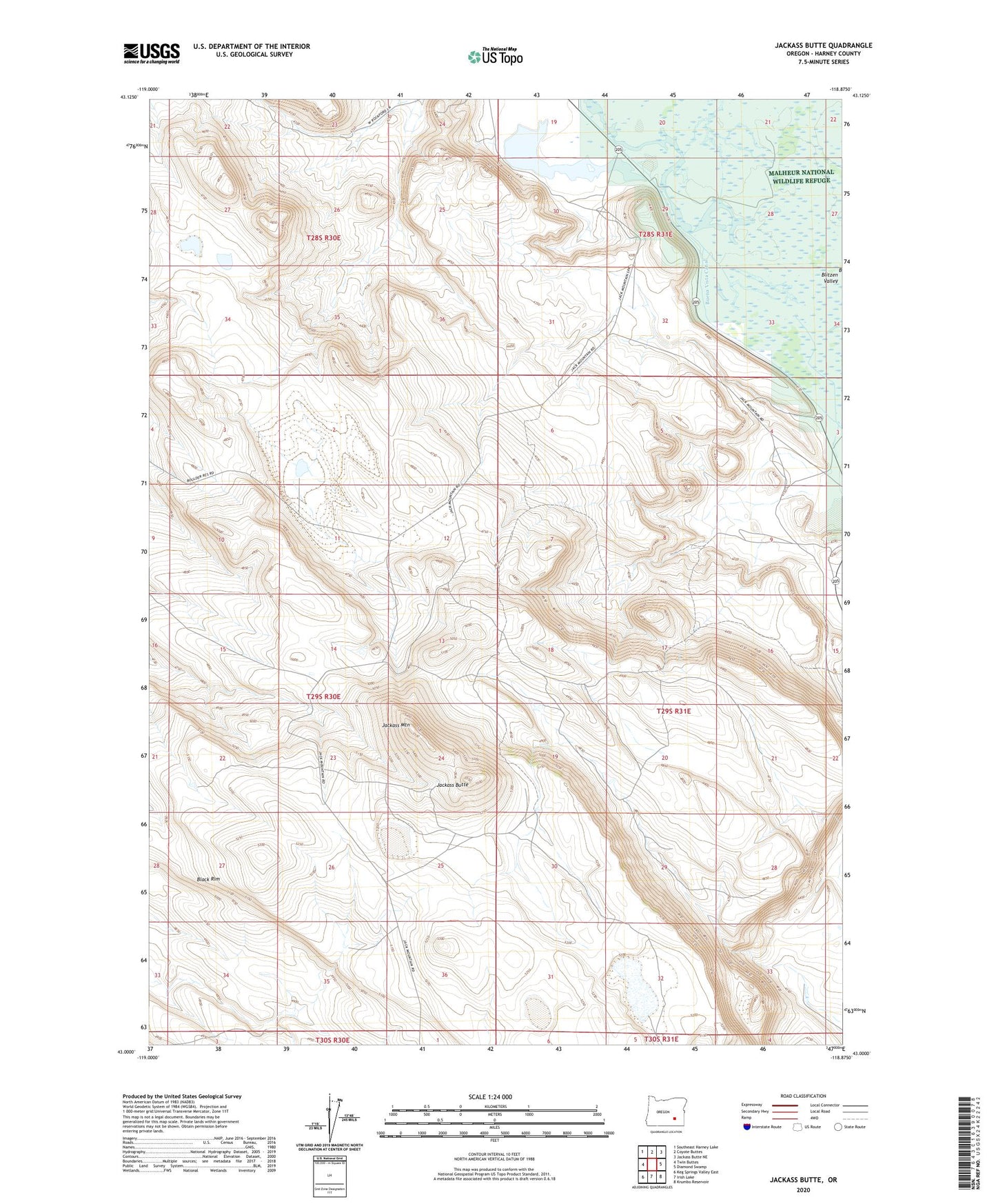
2023 topographic map quadrangle Jackass Butte in the state of Oregon. Scale: 1:24000. Based on the newly updated USGS 7.5' US Topo map series, this map is in the following counties: Harney. The map contains contour data, water features, and other items you are used to seeing on USGS maps, but also has updated roads and other features. This is the next generation of topographic maps. Printed on high-quality waterproof paper with UV fade-resistant inks.
Quads adjacent to this one:
West: Twin Buttes
Northwest: Southeast Harney Lake
North: Coyote Buttes
Northeast: Jackass Butte NE
East: Diamond Swamp
Southeast: Krumbo Reservoir
South: Irish Lake
Southwest: Keg Springs Valley East
This map covers the same area as the classic USGS quad with code o43118a8.
Contains the following named places: Black Rim, Buena Vista Canal, Buena Vista Lake, Harney County, Jackass Butte, Jackass Mountain, Juniper Park Ranch