
MyTopo
Dodson Butte Oregon US Topo Map
Couldn't load pickup availability
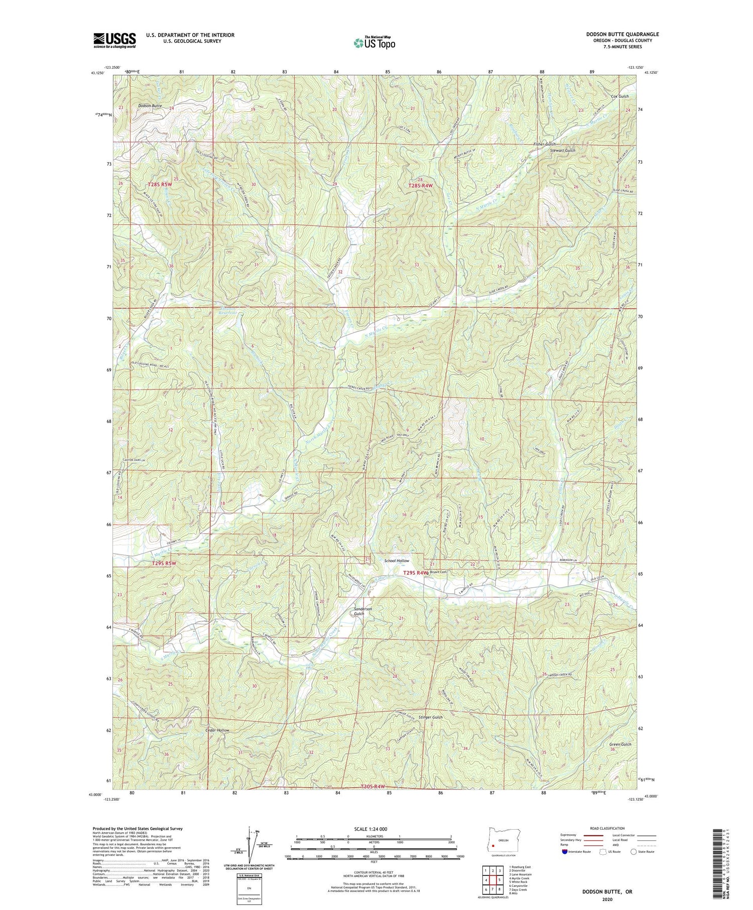
2020 topographic map quadrangle Dodson Butte in the state of Oregon. Scale: 1:24000. Based on the newly updated USGS 7.5' US Topo map series, this map is in the following counties: Douglas. The map contains contour data, water features, and other items you are used to seeing on USGS maps, but also has updated roads and other features. This is the next generation of topographic maps. Printed on high-quality waterproof paper with UV fade-resistant inks.
Quads adjacent to this one:
West: Myrtle Creek
Northwest: Roseburg East
North: Dixonville
Northeast: Lane Mountain
East: White Rock
Southeast: Milo
South: Days Creek
Southwest: Canyonville
Contains the following named places: Ben Branch, Big Lick, Bryant Cemetery, Buck Fork, Buckfork Post Office, Carson Creek, Cavitt Falls, Cedar Grove Church, Cox Gulch, Dodson Butte, Eleanor Reservoir, Fisher Gulch, Frozen Creek, Frozen Creek Mine, Hamline Creek, Heath Creek, Lee Creek, Left Fork Frozen Creek, Lehnherr Park, Little Lick, Louis Creek, Myrtle Creek-Riddle Division, North Myrtle Park, Riser Creek, Roseburg Creek, Sanderson Gulch, School Hollow, Slide Creek, Stewart Gulch, Stone Creek, Weaver Creek, ZIP Code: 97457


