MyTopo
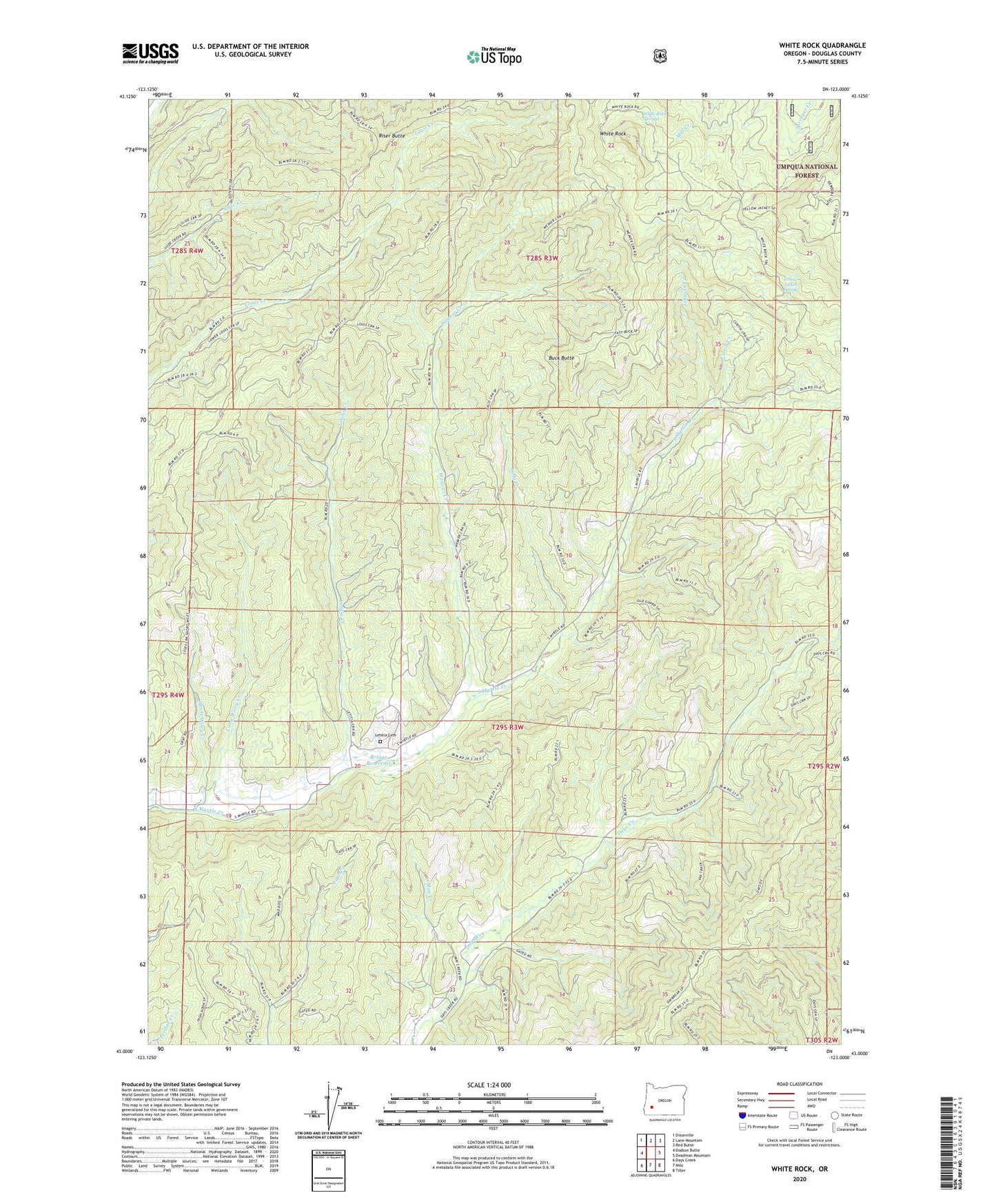
White Rock Oregon US Topo Map
Couldn't load pickup availability
Also explore the White Rock Forest Service Topo of this same quad for updated USFS data
2023 topographic map quadrangle White Rock in the state of Oregon. Scale: 1:24000. Based on the newly updated USGS 7.5' US Topo map series, this map is in the following counties: Douglas. The map contains contour data, water features, and other items you are used to seeing on USGS maps, but also has updated roads and other features. This is the next generation of topographic maps. Printed on high-quality waterproof paper with UV fade-resistant inks.
Quads adjacent to this one:
West: Dodson Butte
Northwest: Dixonville
North: Lane Mountain
Northeast: Red Butte
East: Deadman Mountain
Southeast: Tiller
South: Milo
Southwest: Days Creek
This map covers the same area as the classic USGS quad with code o43123a1.
Contains the following named places: Briggs Reservoir, Buck Butte, Chieftain Mine, Continental Mine, Curtin Creek, Isolate Post Office, Johnson Creek, Lally Creek, Letitia Cemetery, Letitia Creek, Long Wiley Creek, May Creek, Nugget, Nugget Post Office, Riser Butte, Short Wiley Creek, Weaver Creek, White Rock, White Rock Springs, White Rock Trail, Wrights Creek, Yellow Jacket Spring