MyTopo
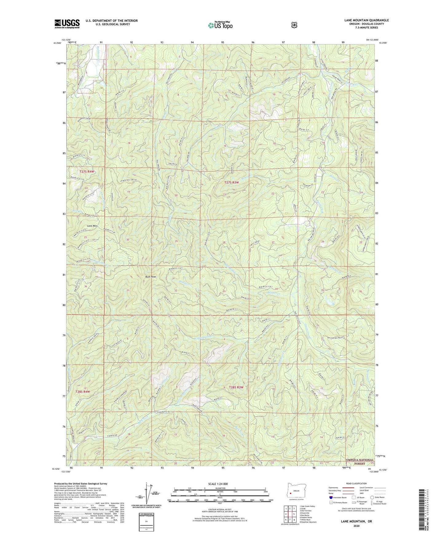
Lane Mountain Oregon US Topo Map
Couldn't load pickup availability
Also explore the Lane Mountain Forest Service Topo of this same quad for updated USFS data
2024 topographic map quadrangle Lane Mountain in the state of Oregon. Scale: 1:24000. Based on the newly updated USGS 7.5' US Topo map series, this map is in the following counties: Douglas. The map contains contour data, water features, and other items you are used to seeing on USGS maps, but also has updated roads and other features. This is the next generation of topographic maps. Printed on high-quality waterproof paper with UV fade-resistant inks.
Quads adjacent to this one:
West: Dixonville
Northwest: Oak Creek Valley
North: Glide
Northeast: Old Fairview
East: Red Butte
Southeast: Deadman Mountain
South: White Rock
Southwest: Dodson Butte
This map covers the same area as the classic USGS quad with code o43123b1.
Contains the following named places: Bond Creek, Boulder Creek, Buck Fork, Buck Fork Trail, Buck Peak, Buck Peak Creek, Buckshot Creek, Caritt Falls Recreation Site, Cavitt Creek, Cavitt Creek Falls Recreation Site, Cavitt Shelter, Collins Creek, Copperhead Creek, Evarts Creek, Hughes Creek, Jim Creek, Lane Mountain, McCaffery Pond, McKay Creek, Mill Creek, Nofog Post Office, Rockland Post Office, Sampson Lake, Springer Creek, Stacey Gulch Creek, White Rock Creek