MyTopo
Milo Oregon US Topo Map
Couldn't load pickup availability
Also explore the Milo Forest Service Topo of this same quad for updated USFS data
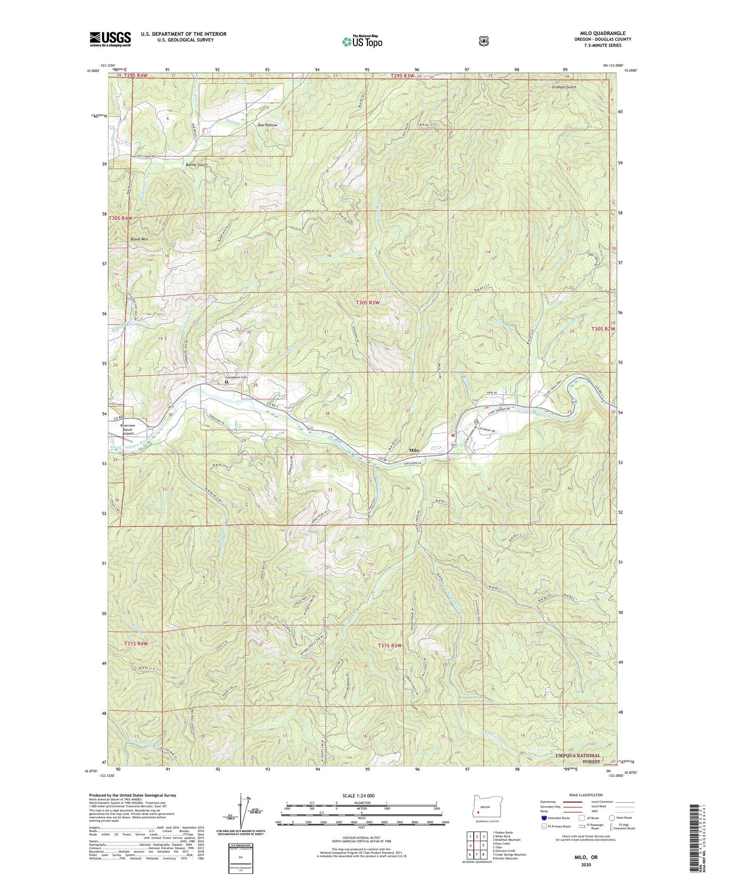
2024 topographic map quadrangle Milo in the state of Oregon. Scale: 1:24000. Based on the newly updated USGS 7.5' US Topo map series, this map is in the following counties: Douglas. The map contains contour data, water features, and other items you are used to seeing on USGS maps, but also has updated roads and other features. This is the next generation of topographic maps. Printed on high-quality waterproof paper with UV fade-resistant inks.
Quads adjacent to this one:
West: Days Creek
Northwest: Dodson Butte
North: White Rock
Northeast: Deadman Mountain
East: Tiller
Southeast: Richter Mountain
South: Cedar Springs Mountain
Southwest: Starvout Creek
This map covers the same area as the classic USGS quad with code o42123h1.
Contains the following named places: Ash Creek, Bailey Gulch, Bland Mountain, Canyon Creek, Cedar Creek, Coble Creek, Coffee Creek, Coon Creek, Corn Creek, Doe Hollow, East Fork Poole Creek, East Fork Stouts Creek, Fate Creek, Gilbeaugh Creek, Hill County Wayside, Lavadoure, Lavadoure Cemetery, Lavadoure Community Hall, Lavadoure Creek, Lick Creek, Miller Mine, Milo, Milo Adventist Academy, Milo Adventist Academy Water Treatment Plant, Milo Boat Launch, Milo Post Office, Milo Rural Fire Protection District, Perdue, Perdue Creek, Perdue Post Office, Poole Creek, Riverview Ranch Airport, Saint John Creek, Stouts Creek, ZIP Code: 97429