MyTopo
Dufur West Oregon US Topo Map
Couldn't load pickup availability
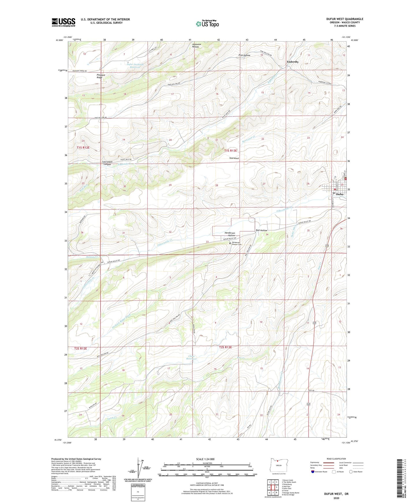
2024 topographic map quadrangle Dufur West in the state of Oregon. Scale: 1:24000. Based on the newly updated USGS 7.5' US Topo map series, this map is in the following counties: Wasco. The map contains contour data, water features, and other items you are used to seeing on USGS maps, but also has updated roads and other features. This is the next generation of topographic maps. Printed on high-quality waterproof paper with UV fade-resistant inks.
Quads adjacent to this one:
West: Wolf Run
Northwest: Brown Creek
North: The Dalles South
Northeast: Petersburg
East: Dufur East
Southeast: Sherars Bridge
South: Postage Stamp Butte
Southwest: Friend
This map covers the same area as the classic USGS quad with code o45121d2.
Contains the following named places: Annalore, Chase Reservoir, City of Dufur, Dufur, Dufur City Hall, Dufur Ditch, Dufur Historical Society Living History Museum, Dufur Orchards Reservoir, Dufur Post Office, Dufur Public Works, Dufur Ranger Station, Dufur Volunteer Fire Department, Endersby, Endersby School, Endersly Post Office, Fargher Airfield, Henderson Hollow, Henderson Pioneer Cemetery, Larch Creek, Lauronzon Canyon, Le Duc Well, Pine Hollow, Rail Hollow, Ramsey Creek, Ramsey Hall, Ramsey Park Grange, Three Springs, United States Forest Service Dufur Ranger Station, Upper Eightmile School, Wolf Run, ZIP Code: 97021