MyTopo
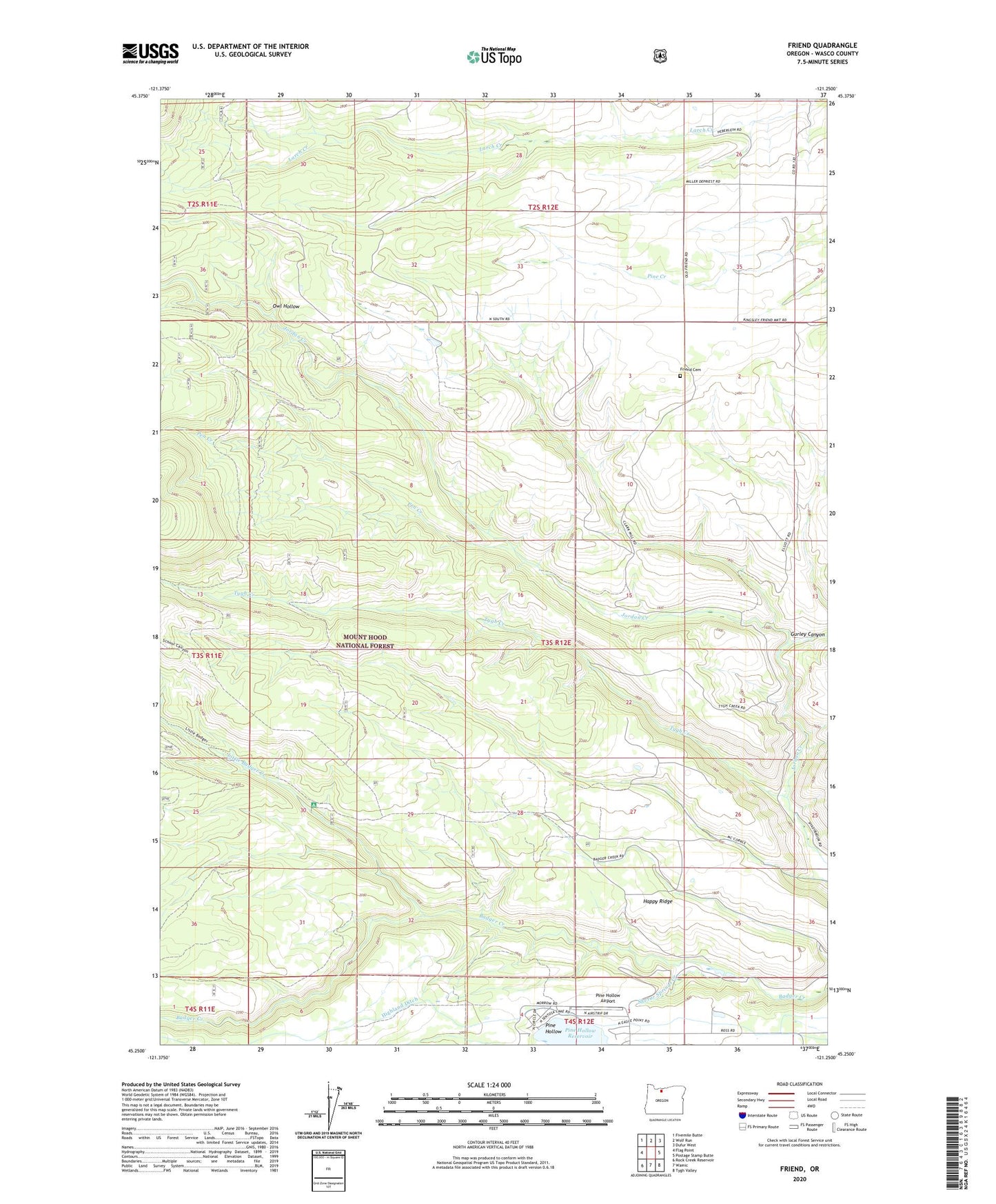
Friend Oregon US Topo Map
Couldn't load pickup availability
Also explore the Friend Forest Service Topo of this same quad for updated USFS data
2023 topographic map quadrangle Friend in the state of Oregon. Scale: 1:24000. Based on the newly updated USGS 7.5' US Topo map series, this map is in the following counties: Wasco. The map contains contour data, water features, and other items you are used to seeing on USGS maps, but also has updated roads and other features. This is the next generation of topographic maps. Printed on high-quality waterproof paper with UV fade-resistant inks.
Quads adjacent to this one:
West: Flag Point
Northwest: Fivemile Butte
North: Wolf Run
Northeast: Dufur West
East: Postage Stamp Butte
Southeast: Tygh Valley
South: Wamic
Southwest: Rock Creek Reservoir
This map covers the same area as the classic USGS quad with code o45121c3.
Contains the following named places: Cascade Hyland Resort, Friend, Friend Cemetery, Friend Post Office, Gurley Canyon, Happy Ridge, Highland Ditch, Jordan Creek, Jordan Quarry, Little Badger Creek, Little Badger Recreation Site, Owl Hollow, Pen Creek, Pine Hollow Airport, Sherar Springs Creek