MyTopo
Duncan Reservoir Oregon US Topo Map
Couldn't load pickup availability
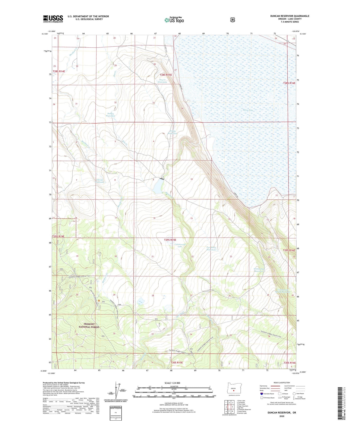
2020 topographic map quadrangle Duncan Reservoir in the state of Oregon. Scale: 1:24000. Based on the newly updated USGS 7.5' US Topo map series, this map is in the following counties: Lake. The map contains contour data, water features, and other items you are used to seeing on USGS maps, but also has updated roads and other features. This is the next generation of topographic maps. Printed on high-quality waterproof paper with UV fade-resistant inks.
Quads adjacent to this one:
West: Hager Mountain
Northwest: Silver Lake
North: Tuff Butte
Northeast: Thorn Lake
East: Egli Rim
Southeast: Summer Lake
South: Foster Butte
Southwest: Thompson Reservoir
Contains the following named places: Cottonwood Lake, Cottonwood Spring Reservoir, Dry Creek Waterhole, Dudley Waterhole, Duncan Creek, Duncan Dam, Duncan Reservoir, Duncan Reservoir Boat Ramp, East Duncan Creek, Farm Well Recreation Site, McCall Creek, O'Keefe Waterhole, Silver Lake, Two Sheep Waterhole, Windy Waterhole, Winkle Flat Reservoir