MyTopo
Silver Lake Oregon US Topo Map
Couldn't load pickup availability
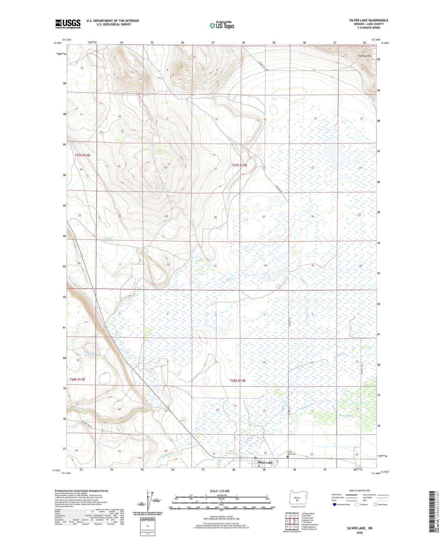
2023 topographic map quadrangle Silver Lake in the state of Oregon. Scale: 1:24000. Based on the newly updated USGS 7.5' US Topo map series, this map is in the following counties: Lake. The map contains contour data, water features, and other items you are used to seeing on USGS maps, but also has updated roads and other features. This is the next generation of topographic maps. Printed on high-quality waterproof paper with UV fade-resistant inks.
Quads adjacent to this one:
West: Oatman Flat
Northwest: McCarty Butte
North: Fort Rock
Northeast: Schaub Lake
East: Tuff Butte
Southeast: Duncan Reservoir
South: Hager Mountain
Southwest: Bridge Creek Draw
This map covers the same area as the classic USGS quad with code o43121b1.
Contains the following named places: Bridge Creek, Buck Creek, Cliff Ranch, Crested Reservoir, Island Branch, Johnson Ranch, Lake County Libraries Silver Lake Branch, Lane Ranch, Linebaugh Ranch, Lonely Reservoir, Paulina Marsh, Porter Ranch, Silver Lake, Silver Lake Cemetery, Silver Lake Census Designated Place, Silver Lake Elementary School, Silver Lake Post Office, Silver Lake Rural Fire Protection District, ZX Ranch