MyTopo
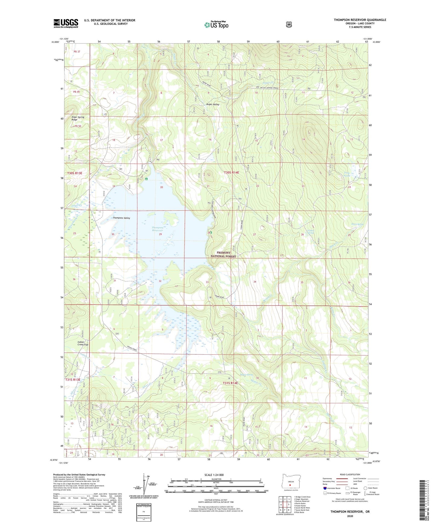
Thompson Reservoir Oregon US Topo Map
Couldn't load pickup availability
Also explore the Thompson Reservoir Forest Service Topo of this same quad for updated USFS data
2024 topographic map quadrangle Thompson Reservoir in the state of Oregon. Scale: 1:24000. Based on the newly updated USGS 7.5' US Topo map series, this map is in the following counties: Lake. The map contains contour data, water features, and other items you are used to seeing on USGS maps, but also has updated roads and other features. This is the next generation of topographic maps. Printed on high-quality waterproof paper with UV fade-resistant inks.
Quads adjacent to this one:
West: Partin Butte
Northwest: Bridge Creek Draw
North: Hager Mountain
Northeast: Duncan Reservoir
East: Foster Butte
Southeast: Pole Butte
South: Sycan Marsh East
Southwest: Sycan Marsh West
This map covers the same area as the classic USGS quad with code o42121h1.
Contains the following named places: Auger Creek, Auger Valley, Benny Creek, Brattain Ridge, East Bay Recreation Site, East Bay Thompson Reservoir Campground Boat Ramp, Frog Ponds, Graham Creek, Guyer Creek, Hawk Creek, Hawk Spring, Indian Creek, Squaw Creek, Squaw Spring, Squaw Spring Corral, Strawberry Creek, Thompson Dam, Thompson Reservoir, Thompson Reservoir Recreation Site, Thompson Valley, Toolbox Spring, Welker Creek