MyTopo
Hager Mountain Oregon US Topo Map
Couldn't load pickup availability
Also explore the Hager Mountain Forest Service Topo of this same quad for updated USFS data
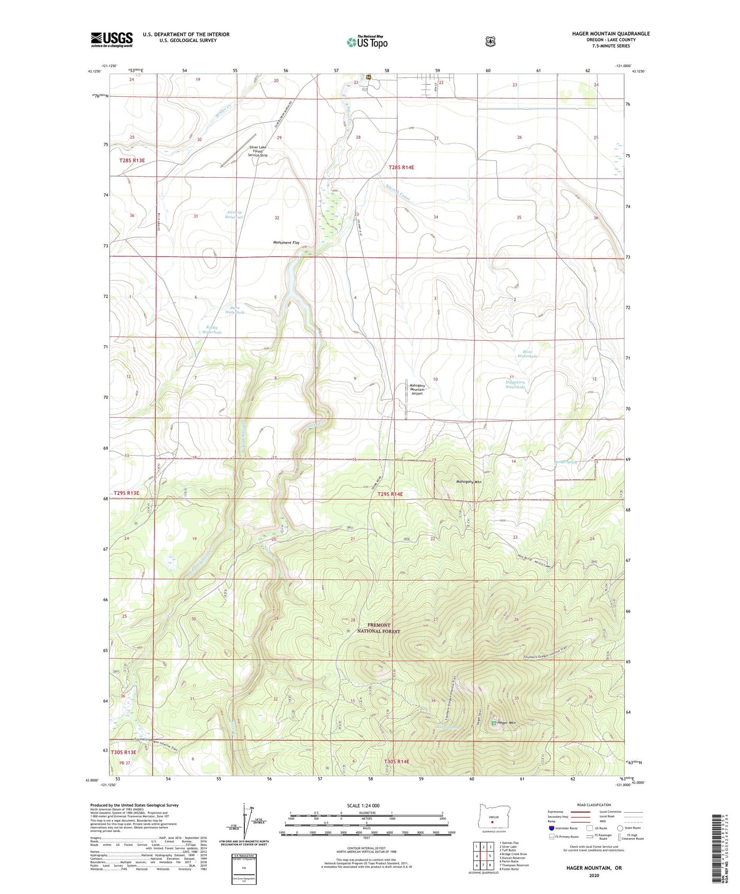
2023 topographic map quadrangle Hager Mountain in the state of Oregon. Scale: 1:24000. Based on the newly updated USGS 7.5' US Topo map series, this map is in the following counties: Lake. The map contains contour data, water features, and other items you are used to seeing on USGS maps, but also has updated roads and other features. This is the next generation of topographic maps. Printed on high-quality waterproof paper with UV fade-resistant inks.
Quads adjacent to this one:
West: Bridge Creek Draw
Northwest: Oatman Flat
North: Silver Lake
Northeast: Tuff Butte
East: Duncan Reservoir
Southeast: Foster Butte
South: Thompson Reservoir
Southwest: Partin Butte
This map covers the same area as the classic USGS quad with code o43121a1.
Contains the following named places: Airstrip Reservoir, Blow Waterhole, Bunyard Crossing Recreation Site, Burn Waterhole, Chase Spring Administrative Study Plot, Gowdy Ranch, Hagadorn Waterhole, Hager Mountain, Hager Mountain Lookout, Hager Spring, Hager Trail, Herder Spring, Mahogany Mountain, Mahogany Mountain Airport, Red and White Airport, Rocky Waterhole, Silver Creek Reservoir, Silver L Canal, Silver Lake Forest Service Strip, Silver Lake Ranger Station, Thompson Valley Diversion Dam, West Fork Silver Creek