
MyTopo
Dutchman Butte Oregon US Topo Map
Couldn't load pickup availability
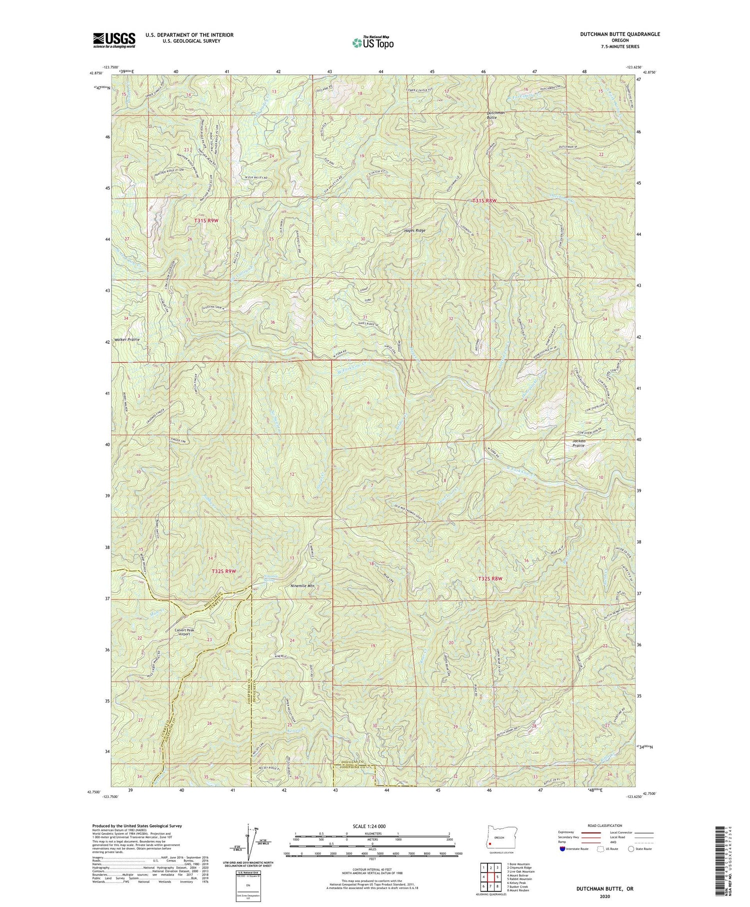
2020 topographic map quadrangle Dutchman Butte in the state of Oregon. Scale: 1:24000. Based on the newly updated USGS 7.5' US Topo map series, this map is in the following counties: Douglas, Curry, Josephine. The map contains contour data, water features, and other items you are used to seeing on USGS maps, but also has updated roads and other features. This is the next generation of topographic maps. Printed on high-quality waterproof paper with UV fade-resistant inks.
Quads adjacent to this one:
West: Mount Bolivar
Northwest: Bone Mountain
North: Chipmunk Ridge
Northeast: Live Oak Mountain
East: Rabbit Mountain
Southeast: Mount Reuben
South: Bunker Creek
Southwest: Kelsey Peak
Contains the following named places: Bear Creek, Bobby Creek, Calvert Peak Airport, Dutchman Butte, Elk Valley Creek, Goat Trail Creek, Hayes Creek, Hayes Ridge, Honeysuckle Creek, Jackass Prairie, Jacob Creek, Ninemile Camp, Ninemile Mountain, Ninemile Spring, No Sweat Creek, North Fork Darby Creek, Slotted Pen Creek, Soldier Creek, Sweat Creek, Walker Prairie, West Fork Darby Creek


