MyTopo
Eightmile Oregon US Topo Map
Couldn't load pickup availability
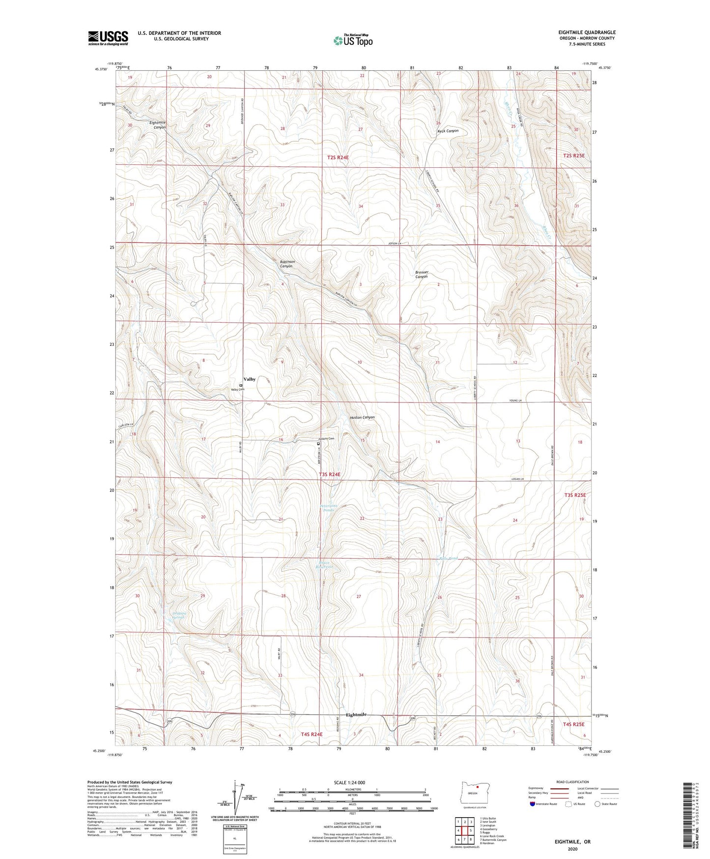
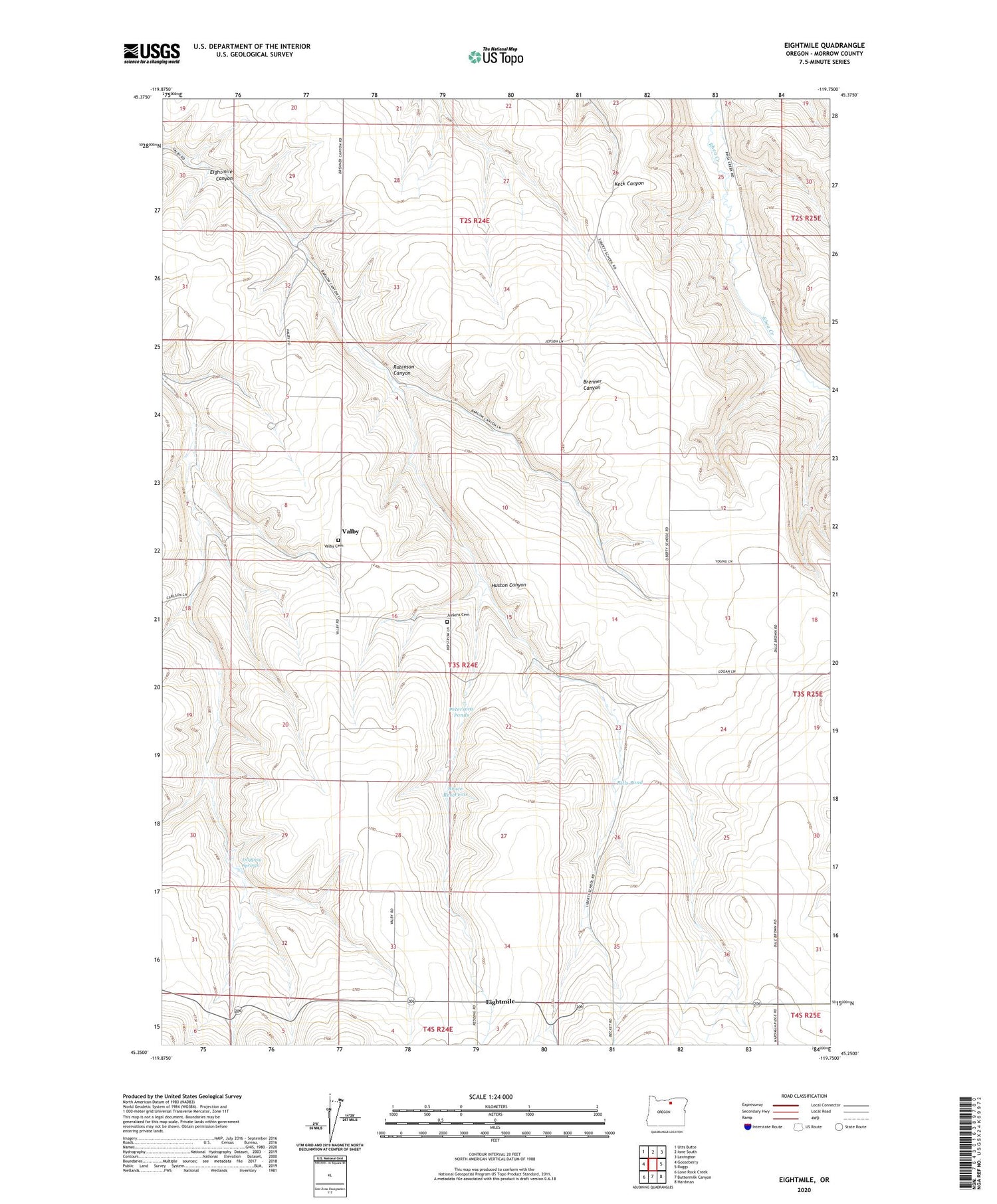
2020 topographic map quadrangle Eightmile in the state of Oregon. Scale: 1:24000. Based on the newly updated USGS 7.5' US Topo map series, this map is in the following counties: Morrow. The map contains contour data, water features, and other items you are used to seeing on USGS maps, but also has updated roads and other features. This is the next generation of topographic maps. Printed on high-quality waterproof paper with UV fade-resistant inks.
Quads adjacent to this one:
West: Gooseberry
Northwest: Utts Butte
North: Ione South
Northeast: Lexington
East: Ruggs
Southeast: Hardman
South: Buttermilk Canyon
Southwest: Lone Rock Creek
Contains the following named places: Bruce Reservoir, Dripping Springs, Eightmile, Eightmile Post Office, Huston Canyon, Junkins Cemetery, Liberty School, Petersons Ponds, Rills Pond, Robinson Canyon, Valby, Valby Cemetery