MyTopo
Elk Prairie Oregon US Topo Map
Couldn't load pickup availability
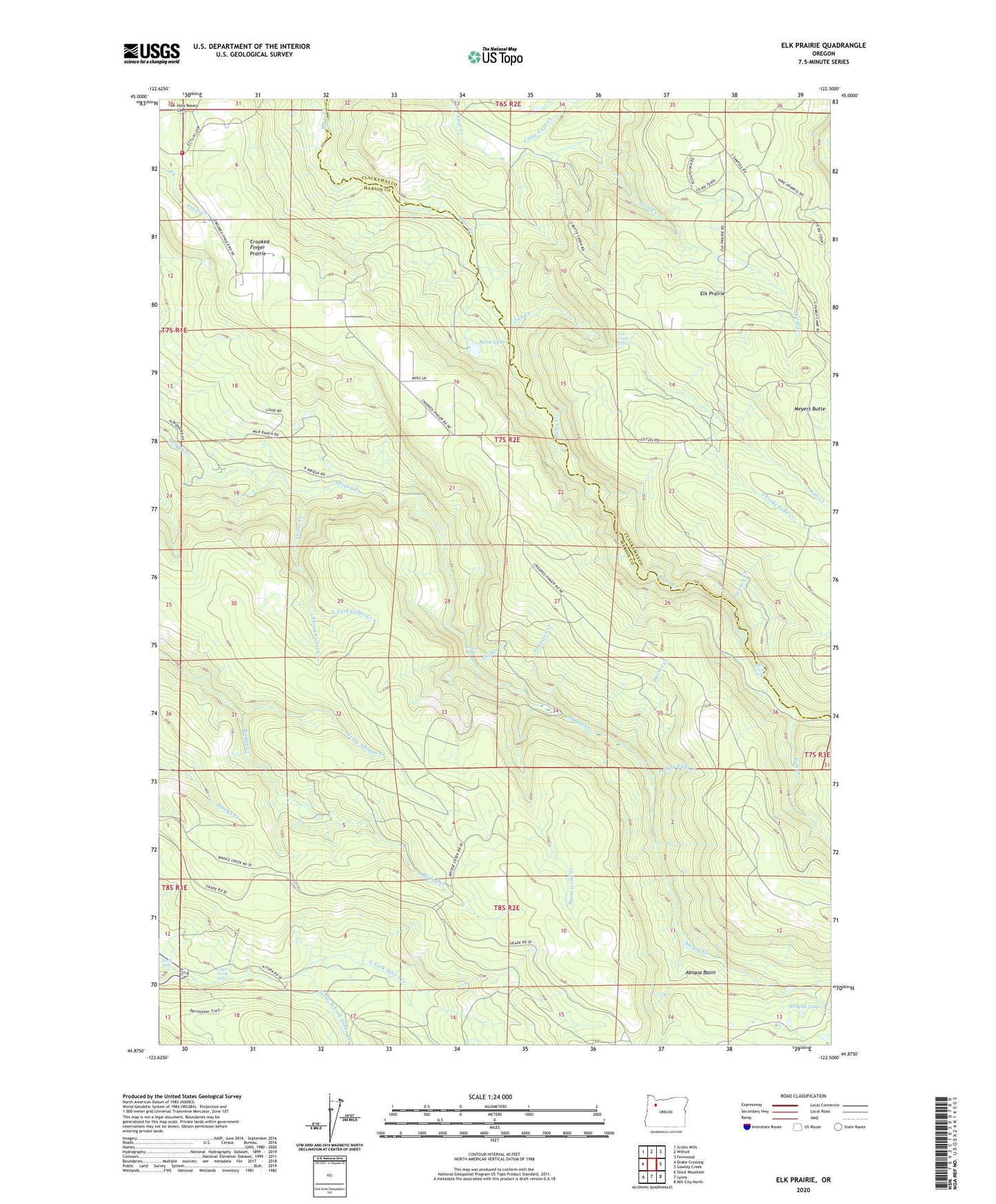
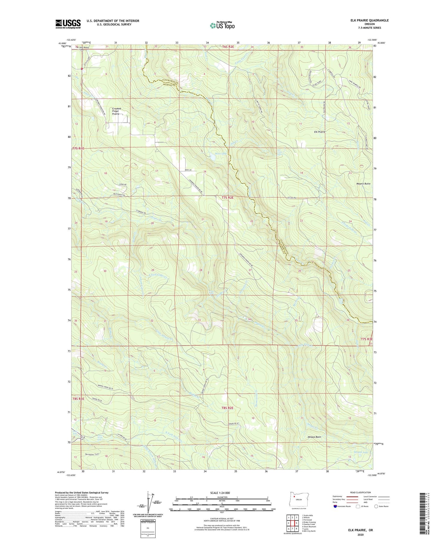
2020 topographic map quadrangle Elk Prairie in the state of Oregon. Scale: 1:24000. Based on the newly updated USGS 7.5' US Topo map series, this map is in the following counties: Marion, Clackamas. The map contains contour data, water features, and other items you are used to seeing on USGS maps, but also has updated roads and other features. This is the next generation of topographic maps. Printed on high-quality waterproof paper with UV fade-resistant inks.
Quads adjacent to this one:
West: Drake Crossing
Northwest: Scotts Mills
North: Wilhoit
Northeast: Fernwood
East: Gawley Creek
Southeast: Mill City North
South: Lyons
Southwest: Stout Mountain
Contains the following named places: Abiqua Basin, Abiqua Creek Park, Abiqua Falls, Abiqua Lake, Betty Jane Deardorff Dam, Bridge Creek, Bridge Creek Post Office, Bucket Creek, Butte Creek Falls, Camp Peterson, Cedar Camp Post Office, Cedar Creek, Crooked Finger Prairie, Crooked Finger School, Elk Prairie, Elk Prairie School, Fall Creek, Fall Creek Falls, Goober Creek, Holy Rosary Cemetery, Holy Rosary Church, Homestead Creek, Johnson Creek, Kautz Mansion, Kirk Creek, Little Coal Creek, Little North Fork Silver Creek, Looney Creek, Marion County, Meyers Butte, Middle Fork Cedar Creek, Moss Lake, North Falls, North Fork Cedar Creek, Priest Creek, Silverton Fire District Station 9 Scotts Mills, South Fork Cedar Creek, South Forks Falls Creek, Trinity Falls Creek, Upper North Falls, ZIP Code: 97375