MyTopo
Stout Mountain Oregon US Topo Map
Couldn't load pickup availability
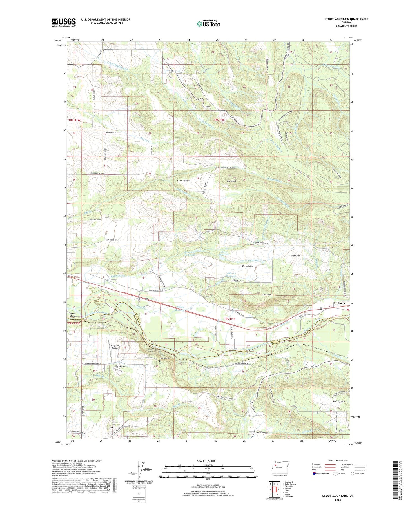
2023 topographic map quadrangle Stout Mountain in the state of Oregon. Scale: 1:24000. Based on the newly updated USGS 7.5' US Topo map series, this map is in the following counties: Marion, Linn. The map contains contour data, water features, and other items you are used to seeing on USGS maps, but also has updated roads and other features. This is the next generation of topographic maps. Printed on high-quality waterproof paper with UV fade-resistant inks.
Quads adjacent to this one:
West: Stayton
Northwest: Stayton NE
North: Drake Crossing
Northeast: Elk Prairie
East: Lyons
Southeast: Snow Peak
South: Jordan
Southwest: Scio
This map covers the same area as the classic USGS quad with code o44122g6.
Contains the following named places: Alder Creek, Alder Creek Reservoir, B F Goodlife Airstrip, Blacktail, Coon Hollow, Fern Ridge, Forbes, Heater Reservoir, Horn Airport, Howard Creek, King, King Post Office, Kingston Airpark, Kinsey Reservoir, Kiphart, Klumb Post Office, Mehama Census Designated Place, Mount Pleasant Cemetery, Mount Pleasant Post Office, Mulkey Creek, North Fork Mill Creek, North Fork Valentine Creek, Park Campground, Payne, Pietrock Cemetery, Siegmund Reservoir, Silver Falls City, Silver Falls Conference Center, Silver Falls State Park, Smith Creek, Smith Creek Youth Camp, South Burn Guard Station, South Fork Mill Creek, South Fork Valentine Creek, Stayton Rural Fire Protection District Mehama Station, Stout Creek, Stout Mountain, Tietz Creek, Tietz Hill, Trask Creek, Upper Bennett Dam, Williams, ZIP Codes: 97383, 97385