MyTopo
Lyons Oregon US Topo Map
Couldn't load pickup availability
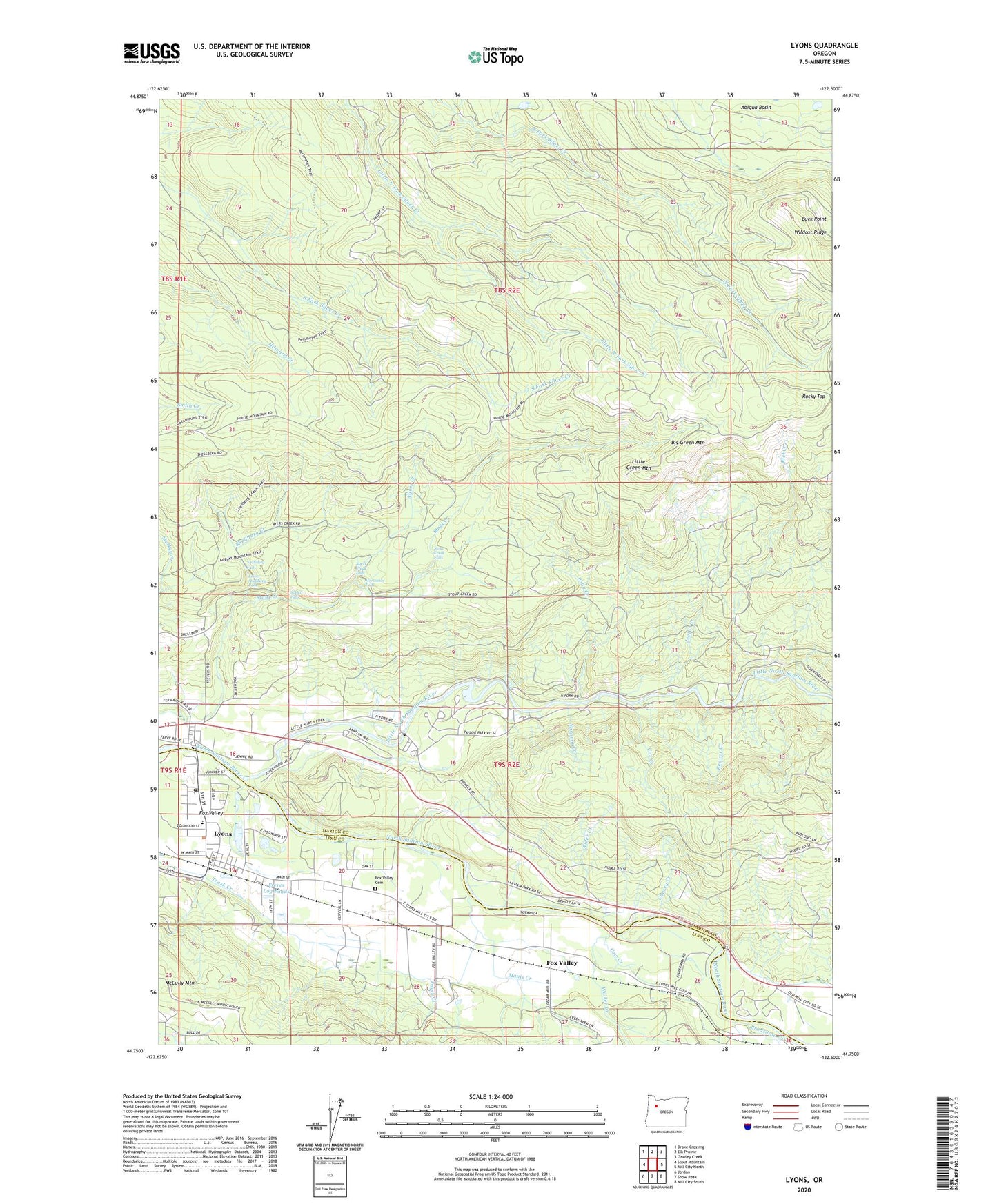
2023 topographic map quadrangle Lyons in the state of Oregon. Scale: 1:24000. Based on the newly updated USGS 7.5' US Topo map series, this map is in the following counties: Marion, Linn. The map contains contour data, water features, and other items you are used to seeing on USGS maps, but also has updated roads and other features. This is the next generation of topographic maps. Printed on high-quality waterproof paper with UV fade-resistant inks.
Quads adjacent to this one:
West: Stout Mountain
Northwest: Drake Crossing
North: Elk Prairie
Northeast: Gawley Creek
East: Mill City North
Southeast: Mill City South
South: Snow Peak
Southwest: Jordan
This map covers the same area as the classic USGS quad with code o44122g5.
Contains the following named places: Alder Creek, Ayers Creek, Ayers Creek Falls, Beaver Creek, Big Green Mountain, Buck Mountain Fire Break, Buck Point, Cherry Creek, City of Lyons, Cow Creek, Cox Creek, Fawn, Fishermen's Bend Bureau of Land Management Boat Ramp, Fox Valley, Fox Valley Cemetery, Fox Valley Post Office, Freres Log Ponds, Freres Lumber, Gooch, Gooch Post Office, Horseshoe Falls, Jeeter Creek, John Neal Memorial County Park, John Neal Memorial County Park Boat Ramp, Kiel Creek, Little Green Mountain, Little North Santiam River, Lower Shellburg Falls, Lyons, Lyons - Mehama County Park Boat Ramp, Lyons City Hall, Lyons Log Pond, Lyons Mehama County Park, Lyons Post Office, Lyons Public Library, Lyons Rural Fire Protection District Station 1, Manis Creek, Mari - Linn Elementary School, McCully Mountain, Mehama, Mehama Post Office, Noroma Creek, North Fork County Park, North Santiam State Park, Ornoname 7 Dam, Polly Creek, Rocky Top, Santiam Valley Grange, Shellburg Creek, Shellburg Falls, South Silver Creek Youth Camp, Stasel Falls, Stout Creek Falls, Taylor Grove, Walker Creek, Weatbery, ZIP Code: 97384