MyTopo
Gawley Creek Oregon US Topo Map
Couldn't load pickup availability
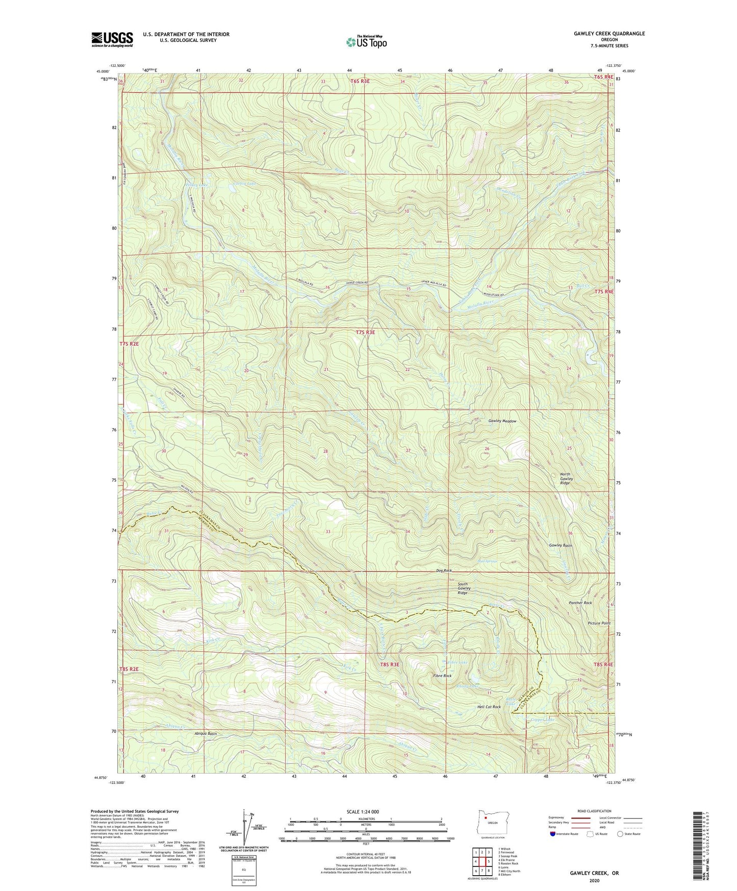
2023 topographic map quadrangle Gawley Creek in the state of Oregon. Scale: 1:24000. Based on the newly updated USGS 7.5' US Topo map series, this map is in the following counties: Clackamas, Marion. The map contains contour data, water features, and other items you are used to seeing on USGS maps, but also has updated roads and other features. This is the next generation of topographic maps. Printed on high-quality waterproof paper with UV fade-resistant inks.
Quads adjacent to this one:
West: Elk Prairie
Northwest: Wilhoit
North: Fernwood
Northeast: Soosap Peak
East: Rooster Rock
Southeast: Elkhorn
South: Mill City North
Southwest: Lyons
This map covers the same area as the classic USGS quad with code o44122h4.
Contains the following named places: Avalanche Creek, Bear Creek, Bee Ranch, Boar Camp, Bull Creek, Butte Lakes, Copper Lake, Copperhead Creek, Corbia Lake, Cow Creek, Dandelion Creek, Dog Rock, Fibre Creek, Fibre Lake, Fibre Rock, Fill Creek, Gawley Basin, Gawley Creek, Gawley Meadow, Hell Cat Rock, Horse Creek, Inventory Creek, Lookout Mountain Lookout, Mud Springs, Murphy Camp, North Gawley Ridge, Panther Rock, Pelkey Lake, Picture Point, Pine Crest Trail, Rhody Lake, Shoofly Creek, Slide Creek, South Fork Butte Creek, South Gawley Ridge, Sucker Creek, Sweet Spring Creek, Trestle Creek