MyTopo
Drake Crossing Oregon US Topo Map
Couldn't load pickup availability
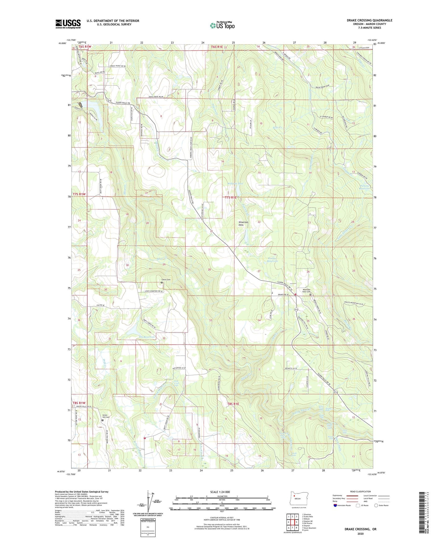
2023 topographic map quadrangle Drake Crossing in the state of Oregon. Scale: 1:24000. Based on the newly updated USGS 7.5' US Topo map series, this map is in the following counties: Marion. The map contains contour data, water features, and other items you are used to seeing on USGS maps, but also has updated roads and other features. This is the next generation of topographic maps. Printed on high-quality waterproof paper with UV fade-resistant inks.
Quads adjacent to this one:
West: Stayton NE
Northwest: Silverton
North: Scotts Mills
Northeast: Wilhoit
East: Elk Prairie
Southeast: Lyons
South: Stout Mountain
Southwest: Stayton
This map covers the same area as the classic USGS quad with code o44122h6.
Contains the following named places: Argenti Post Office, Brooks Creek, Double Falls, Drake Crossing, Drake Falls, Drakes Crossing Rural Fire Protection District, Drift Creek Falls, East Fork Drift Creek, Echo Creek, Fox Dam, Fox Reservoir, Hammond Creek, Hullt, Hullt Post Office, Jeff Creek, KECH-TV, Knight Post Office, Koehler Reservoir, KSKD-FM, Lewis Cemetery, Little Abiqua Creek, Lower North Falls, Lower South Falls, Middle North Falls, Mountain View Cemetery, North Fork Silver Creek, North Silver Creek Youth Camp, Pichette Reservoir, Silver Creek Dam, Silver Creek Reservoir, Silver Crest Elementary School, Silverton Division, Silverton Hills, Silverton Hills Grange, Silverton Reservoir City Marine Park Boat Docks, Silverton Reservoir City Marine Park Boat Ramp, Skookum Tum Tum Park, South Falls, South Fork Silver Creek, Sublimity Fire District Station 52 Substation, Twin Falls, Union Hill Cemetery, Union Hill Grange, West Fork Drift Creek, Willards Dam, Willards Pool, Winter Falls, ZIP Code: 97381