MyTopo
Encina Oregon US Topo Map
Couldn't load pickup availability
Also explore the Encina Forest Service Topo of this same quad for updated USFS data
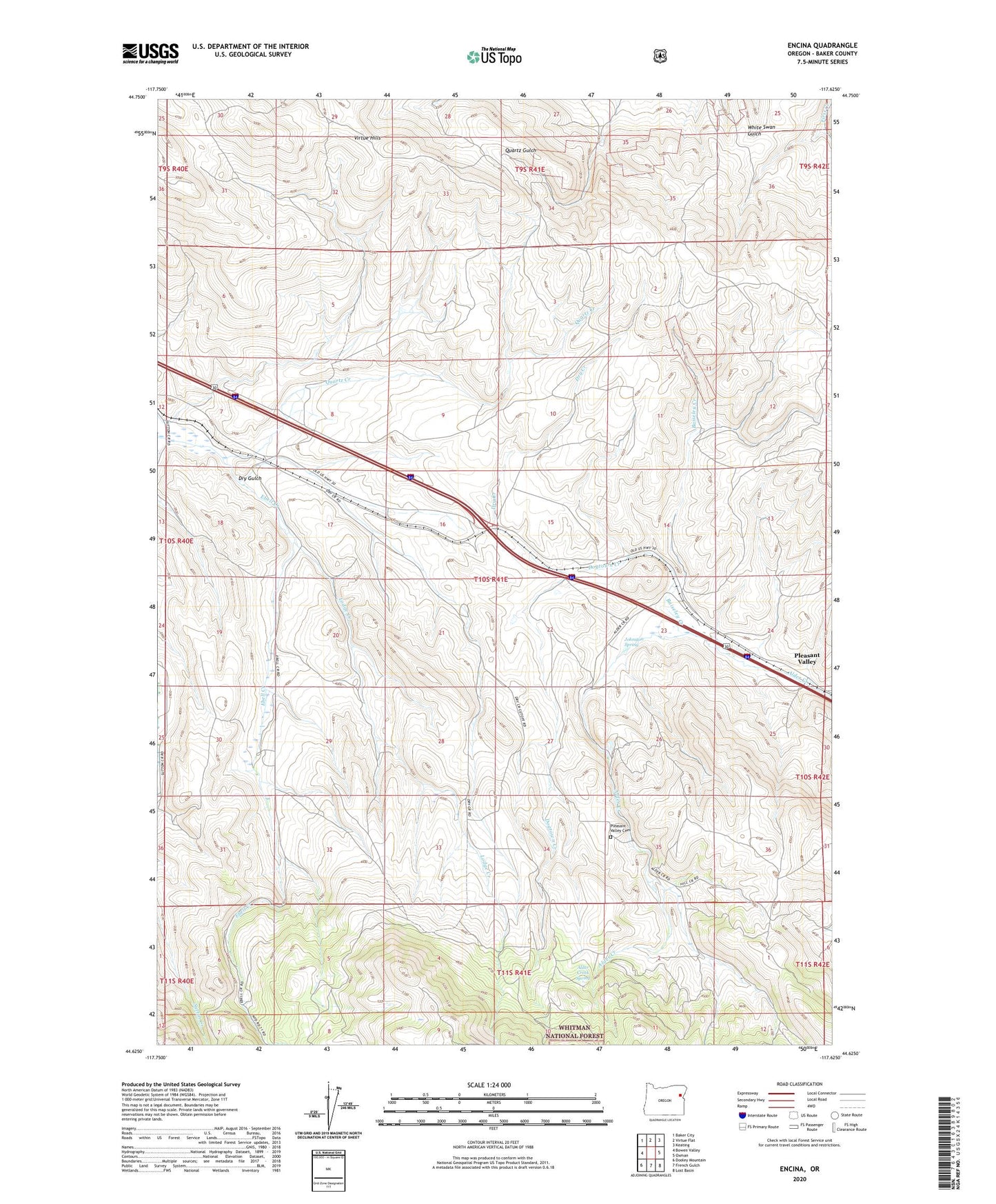
2024 topographic map quadrangle Encina in the state of Oregon. Scale: 1:24000. Based on the newly updated USGS 7.5' US Topo map series, this map is in the following counties: Baker. The map contains contour data, water features, and other items you are used to seeing on USGS maps, but also has updated roads and other features. This is the next generation of topographic maps. Printed on high-quality waterproof paper with UV fade-resistant inks.
Quads adjacent to this one:
West: Bowen Valley
Northwest: Baker City
North: Virtue Flat
Northeast: Keating
East: Oxman
Southeast: Lost Basin
South: French Gulch
Southwest: Dooley Mountain
This map covers the same area as the classic USGS quad with code o44117f6.
Contains the following named places: Aitken, Alder Creek Spring, Baiseley Creek, Baker County, Brazos Mine, Dogtown Creek, Dry Creek, Dry Gulch, Encina, Johnston Spring, Lodge Creek, Norton, Pleasant Valley, Pleasant Valley Cemetery, Pleasant Valley Speedway and Dragstrip, Quartz Creek, Uncle Dan Mine, Virtue Hills, White Swan Mine