MyTopo
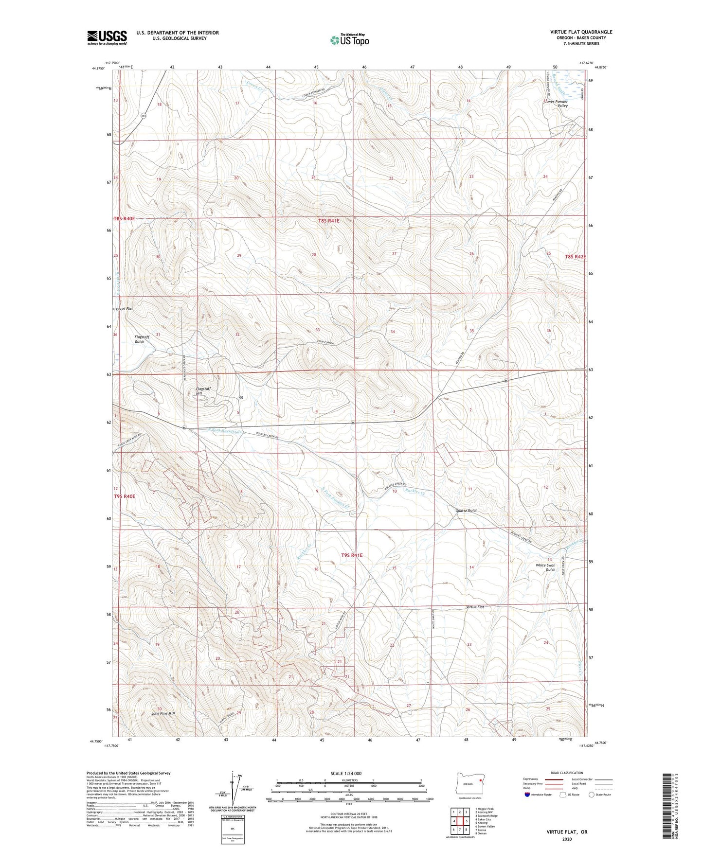
Virtue Flat Oregon US Topo Map
Couldn't load pickup availability
Also explore the Virtue Flat Forest Service Topo of this same quad for updated USFS data
2023 topographic map quadrangle Virtue Flat in the state of Oregon. Scale: 1:24000. Based on the newly updated USGS 7.5' US Topo map series, this map is in the following counties: Baker. The map contains contour data, water features, and other items you are used to seeing on USGS maps, but also has updated roads and other features. This is the next generation of topographic maps. Printed on high-quality waterproof paper with UV fade-resistant inks.
Quads adjacent to this one:
West: Baker City
Northwest: Magpie Peak
North: Keating NW
Northeast: Sawtooth Ridge
East: Keating
Southeast: Oxman
South: Encina
Southwest: Bowen Valley
This map covers the same area as the classic USGS quad with code o44117g6.
Contains the following named places: Baker City Division, Bureau of Land Management Wastewater Treatment Lagoons, Cliff Mine, Columbia Mine, Con-Virginia Mine, Emma Mine, First Creek, Flagstaff Gulch, Flagstaff Hill, Flagstaff Mine, Friday Mine, Gray Eagle Mine, Hidden Treasure Mine, Leo Adler Theatre, Lone Pine Mountain, National Historic Oregon Trail Interpretive Center, North Fork Ruckles Creek, Oregon Trail Historic Interpretive Center Amphitheater, Oregon Trail Historical Monument, Quartz Gulch, Rachel Mine, Saint Paul Mine, Virtue Flat, Virtue Mine, White Swan Gulch