MyTopo
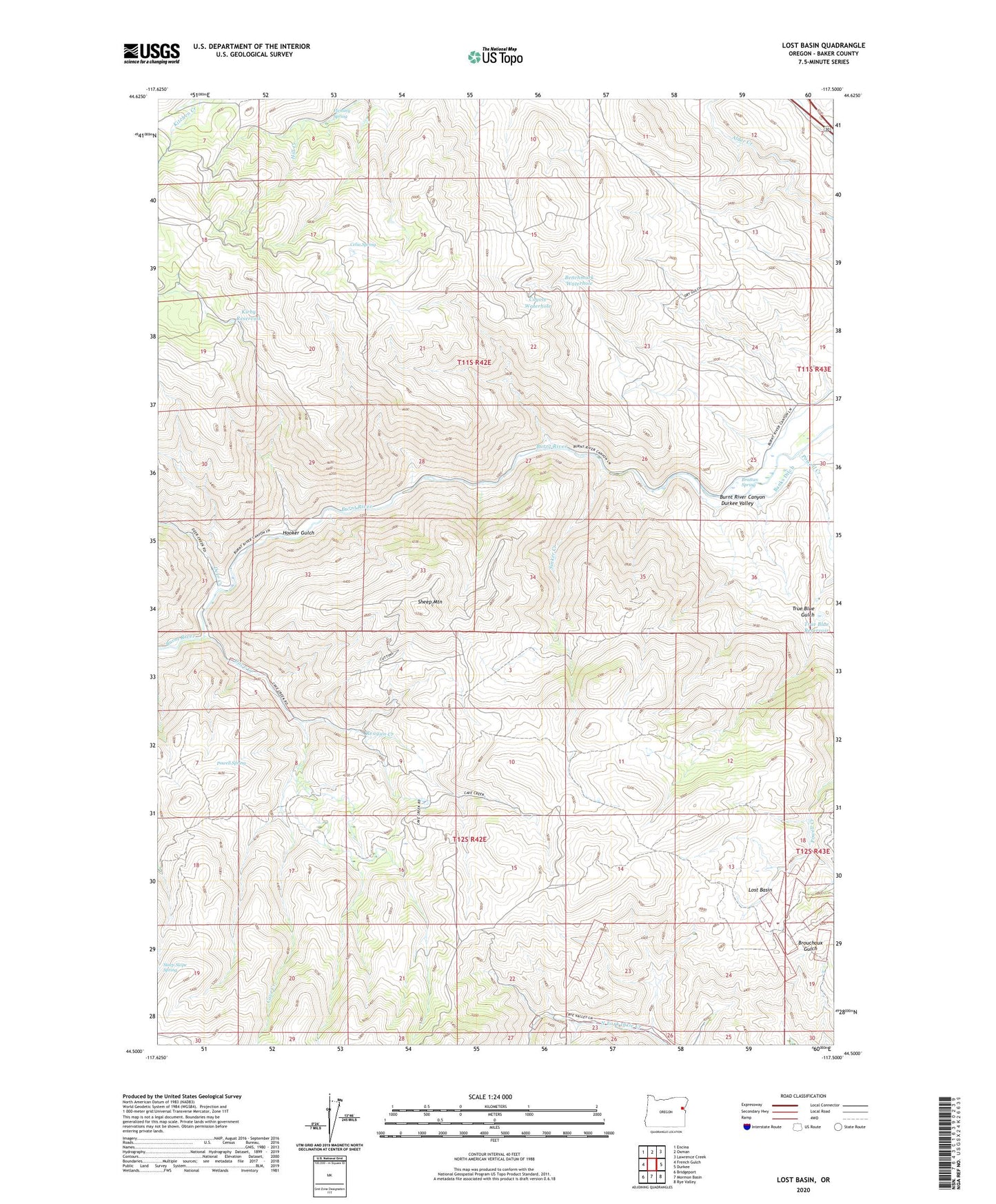
Lost Basin Oregon US Topo Map
Couldn't load pickup availability
Also explore the Lost Basin Forest Service Topo of this same quad for updated USFS data
2023 topographic map quadrangle Lost Basin in the state of Oregon. Scale: 1:24000. Based on the newly updated USGS 7.5' US Topo map series, this map is in the following counties: Baker. The map contains contour data, water features, and other items you are used to seeing on USGS maps, but also has updated roads and other features. This is the next generation of topographic maps. Printed on high-quality waterproof paper with UV fade-resistant inks.
Quads adjacent to this one:
West: French Gulch
Northwest: Encina
North: Oxman
Northeast: Lawrence Creek
East: Durkee
Southeast: Rye Valley
South: Mormon Basin
Southwest: Bridgeport
This map covers the same area as the classic USGS quad with code o44117e5.
Contains the following named places: Benchmark Waterhole, Brattan Spring, Burnt River Canyon, Cave Creek, Celia Spring, Chambeam Ditch, Coyote Waterhole, Cutting Mine, Deer Creek, Eddy Slough, Fleming Spring, Hooker Gulch, Kirby Reservoir, Lander, Lost Basin, Powell Creek, Powell Spring, Reagan Creek, Sheep Mountain, Sinker Creek, Steep Slope Spring, True Blue Gulch, True Blue Reservoir